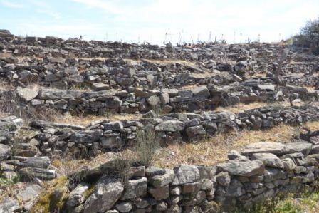
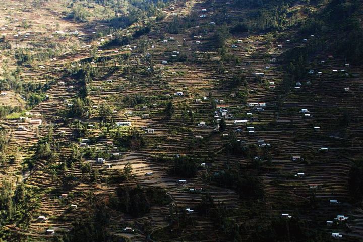
Arequipa: A City with Terraces in Southern Peru
Affiliations
- 1 Universidad Nacional Agraria La Molina, Lima, Peru
- 2 Medical Technical laboratory, Lima, Peru
- 3 Independent hydrogeologist, Huelva, Spain
The Journal of Terraced Landscapes volume 1, issue 1, pp. 86–105 (2020) · Cite this article
- 203 views
- 356 downloads
- DOI10.5281/zenodo.5819569

Abstract
The city of Arequipa, Southern Perú is located at 2,700 m a.m.s.l. . in a semi desert zone, the Oceanic Yunga, as an extension of the Atacama Desert. This zone presents gorges and steep slopes which have been transformed in agricultural terraced systems since Pre-hispanic times. Most of these systems are currently in use at the localities of Yumina, Sabandía, Paucarpata, Carmen Alto, Tingo, Tiabaya, Chilina, Cayma and Yura. The traditional crops on these terraces are: maize, vegetables, cucurbitaceous and alfalfa. Most of the properties belong to the traditional farmers known as lonccos who maintain their own language and culture. The urban expansion and specially the need for water sources for urban domestic use are threatening the continuity of these traditional systems of agricultural production.
Keywords
- Arequipa
- terraces
- traditional farmers
- crops
- risks
Dedicated to the memory of Mourik Bueno de Mezquita
“In Peru we are witnesses of the economic, social and political marginalisation of our terraced landscapes, symbols of the unique wisdom, the Quechua and Aymara heritage.” John Earls, 2015
1. Introduction
Terrace systems in Peru are considered to have covered more than 400,000 ha (Masson, 1983). In Inca times these were preferably cultivated with corn, transforming the soils located on nonproductive slopes, into fields of intensive agriculture throughout the entire Andean mountain range (Donkin, 1979).
These terraces, called pata in pre-Columbian Peru, fulfilled various functions, such as soil conservation (Felipe Morales, 1987) and better use of water, avoiding or decreasing soil erosion (Masson, 1983; Denevan, 1986; Alfaro et al. 1986; Felipe Morales, 2004). But above all they were a strategy to expand the agricultural frontier, creating favourable microclimatic conditions for crops and ensuring food with the adaptation of new varieties of agrobiodiversity present in the Andes (Tapia, 2007).
At the Andean level, there is evidence that some terraces located on continuous terrain and covering important altitude differences, were used as research centres in the climatic adaptation of Andean crops (Earls, 1987).
Background
The study of the conditions, conservation and promotion of the terraces has been the subject of different publications, seminars, and conferences both in Peru (Concytec, 1986; Kendall, 1992; Benavides, 2004), as well as in International Congresses. The second Congress on Terraced Landscapes Encounters of Cultures and Knowledge from Terraces in the World took place in 2014 in Cusco, Peru (Tillmann, Bueno de Mesquita, 2015). In 2013 even a Program for the Inventory and Conservation of terraces was financed by the IDB and with the participation of the Ministry of Agriculture of Peru, which aimed to carry out the recovery of terraces and undertake an inventory of these agricultural systems at the national level, with the goal to increase agricultural productivity, improve food security and strengthen articulation to markets in poor areas (Lambruschini, 2015). The program began in 28 districts of 11 regions of the country and 16,000 ha of terraces were involved with the execution of works by the Cooperation Fund for Social Development FONCODES. To date, these government actions have not been continued and rather the regional governments have taken some initiatives.
A special situation is the presence of vestiges of terraces within the perimeters of cities, as is the case of Cusco (Vega Centeno, 2015) and the subject discussed here in the city of Arequipa, where urban expansion constitutes a threat to their subsistence, as well as competition for the use of water for domestic purposes.
In the Arequipa region, the extensive terraces systems of the Colca Canyon area in the province of Cailloma (Denevan, 1986; Córdova, 2004) and also in the Cotahuasi Canyon (Tejada, 2010) in the province of La Unión are highly admired. Along with Chuquibamba, they are eminently rural localities, distant from the city of Arequipa and with extensive areas in current agricultural production of corn, potatoes, quinua (Chenopodium quinoa Wild) and kiwicha (Amaranthus caudatus L.), also constituting important areas of tourist attraction, for its landscape beauty.
The principal objective here is to give evidence of the presence of ancient terraces in Arequipa as much as the influence of the urban expansion to affect the use of the water resources affecting the maintenance of the terraces.
2. Data and Methodology
The methodology used has consisted of a review of the existing bibliography on the matter, in addition, research was carried out in the field consisting of personal visits to the main areas and producers of the terraces in Arequipa in order to define the current situation regarding conflicts between the urban expansion and availability of water for agricultural use.
Satellite imaging has been used to assess the state of the terraced areas and associated infrastructures (aqueducts and reservoirs).
3. Results
Locality
Arequipa, the capital city of the region of the same name, at 2,700 a.m.s.l., is the second largest city in Peru, due to the number of population and its economic importance.
It is located on the western slope of the Andes in the highest part of the Maritime Yunga Region according to the classification of natural regions of Peru by Pulgar Vidal (1971). It has a desert climate of less than 250 mm of precipitation per year, concentrated in the months of January to March and where agriculture requires complementary irrigation for production.
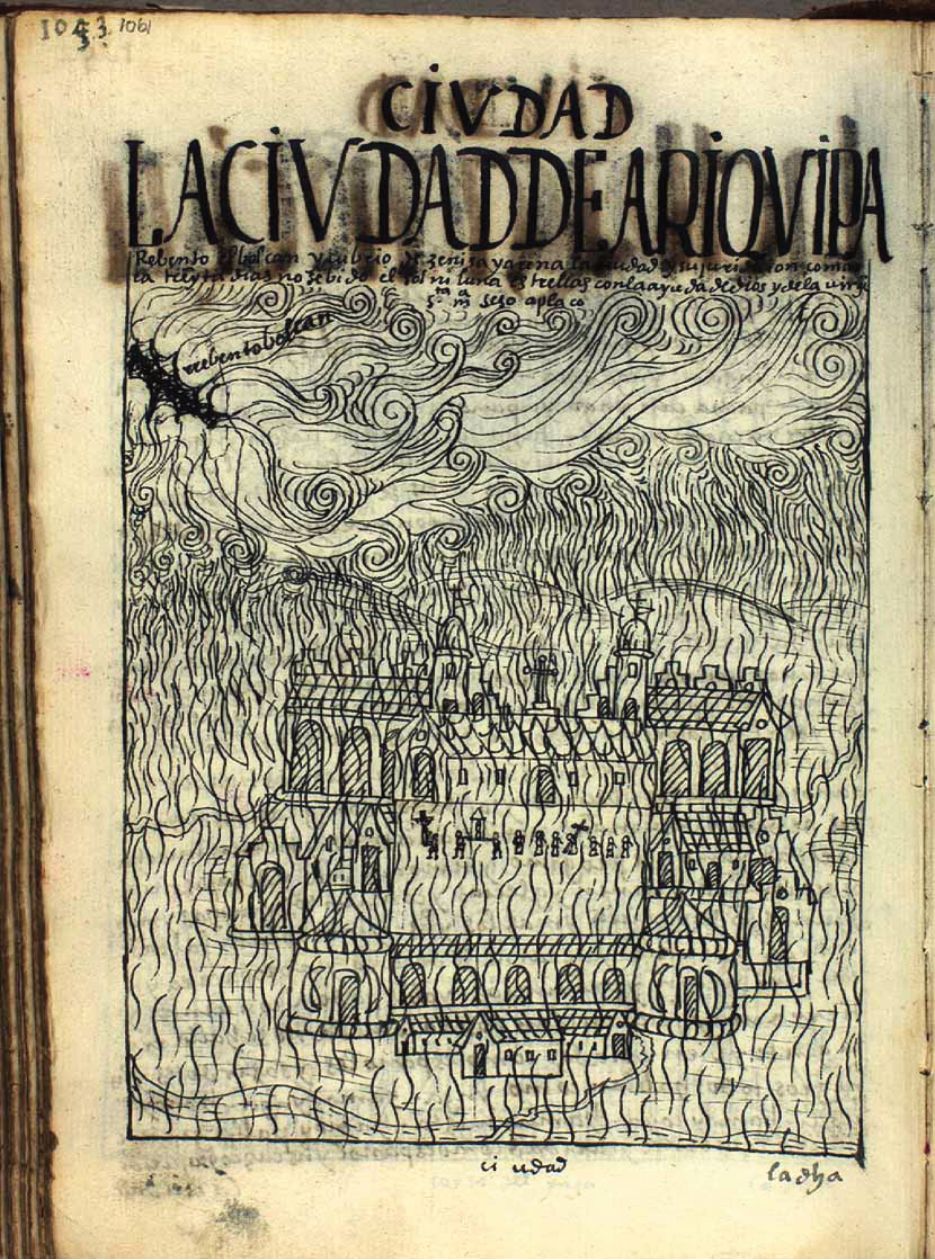
It should be noted that the city is surrounded by three volcanoes with the risks that this entails: Misti stands out among them with its 5,822 m a.m.s.l. and is still active, with different catastrophic episodes in history (Poma de Ayala, 1615) (Figure 1), and on its sides, the Chachani volcano (6,025 m a.m.s.l.) and Pichu Pichu (5,500 m a.m.s.l.). all are part of the Western Cordillera of the Andes.
On the other hand, volcanic materials were historically used for construction, Arequipa is also called the white city because of the sillar, which is a porous volcanic rock abundant in local quarries, with which the churches, convents and houses of the historic centre are built. These mountains also form ravines on their slopes, which when used through the construction of terraces for agricultural purposes, constitute a special and little promoted attraction. The numerous streams that cross the city were originally carpeted with platforms of different origins: pre-Inca, Inca and even from the colonial era, after the Spanish invasion in the 16th century (Salas and Vásquez, 1984). Currently, the terraces of the Chili river ravine, called Chilina, which crosses the city, and those located in the ravines of the surrounding districts remain.
Arequipa has been inhabited through the centuries by different ethnic groups and cultures, among them the Tiahuanaco of the Peruvian-Bolivian Altiplano, the Wari of Ayacucho and the Chiribaya of Moquegua. Although there is no consensus as to its origin, the Cabana who came from Chuquibamba were possibly the first to build terraces systems especially for the cultivation of corn. Julien (2002) indicates that they were the orejones, Inca technical experts, who came in the fourteenth century to perfect the terraces with the Inca model that includes the construction of retaining walls, water catchment and irrigation systems, drainage, change of soils and infrastructure to facilitate access. These sophisticated systems remain to this day.
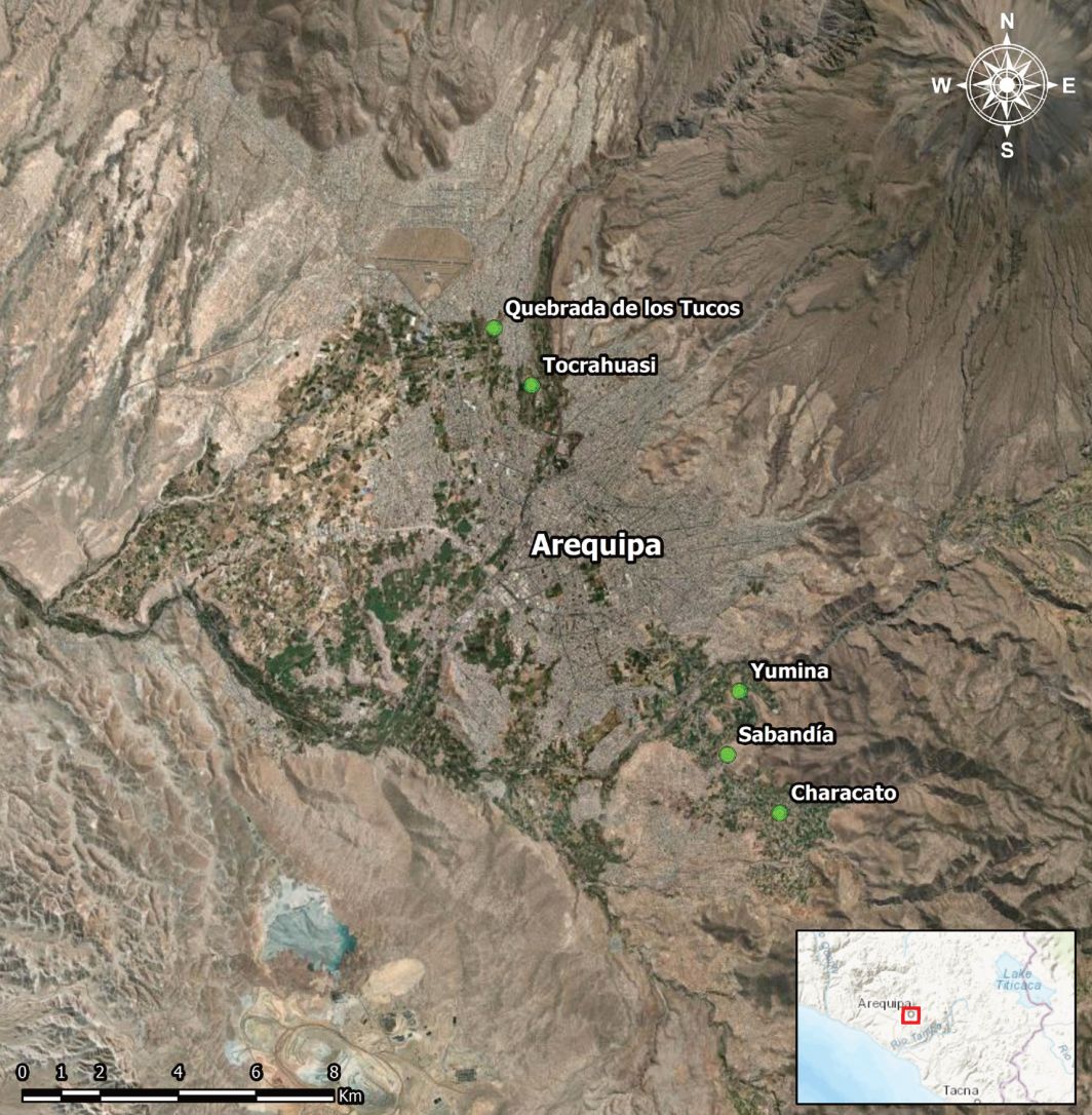
In the city of Arequipa, the most important terraces systems are those of Chilina, Yumina and Sabandía; those of Paucarpata, also the terraces of Tiabaya, Sachaca, Socabaya, Cayma and streams such as Los Tucos and Tocrahuasi. Figure 2 shows the sectors we have analysed.
On December 2, 2000, the Historic Centre of the city of Arequipa was declared World Cultural Heritage of Humanity by UNESCO in merit of its architectural beauty and the landscape reserve of the countryside. By including the countryside, tribute was paid to the landscapes with terraces, especially the Chilina countryside that is located on the edge of the historic centre of the city. Water resources are originated from the river Chili.
Yumina
Yumina for a long time was the most important town in the area due to its elaborate platforms and the presence of a ceremonial complex linked to the cult of the Misti volcano (Cardona, 2002). At the time of the Cusco expansion, the Inka sent mitimaes or displacement of groups of related families to new locations with the intention of pacifying or colonizing the expansion areas (Julien, 2002). This is how the presence of orejones or experts who promoted agriculture and brought innovative technologies such as more sophisticated terraces are mentioned, with the incorporation of siphons to transfer water from the slopes of the Pichu. The same author recalls that the experts or orejones were only sent to places with strategic or ceremonial importance. Until today, the water springs, called eyes of water, among them that of Yumina Lourdes, El Milagro and El Bautista, supplied by the snow of Pichu, contribute to the supply of water for the terraces and human consumption.
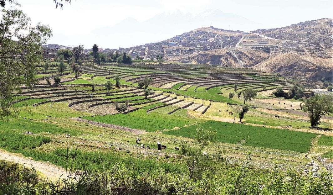
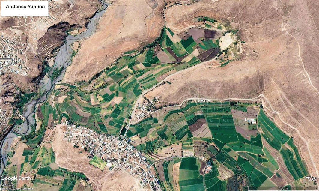
Figure 3 shows the Yumina terraces and Figure 4 shows its spatial distribution and its sinuous shapes in symmetry with the contour lines, as is usual in these technologies, in order to graduate the energy of surface waters and distribute it by gravity. At the same time infiltration that feeds soils and aquifers is favoured.
Sabandía
Sabandía is considered to be an example of a typical dairy farm and resting place for muleteers (Galdós, 1993). It was supplied with several water springs that allowed the construction of a vast set of terraces, as well as several wheat mills, which was a very important crop in colonial times. However, the use and shifts of these springs led to constant confrontations between the residents of Sabandía, Yumina and Characato (Bedregal, Martínez, 2008).
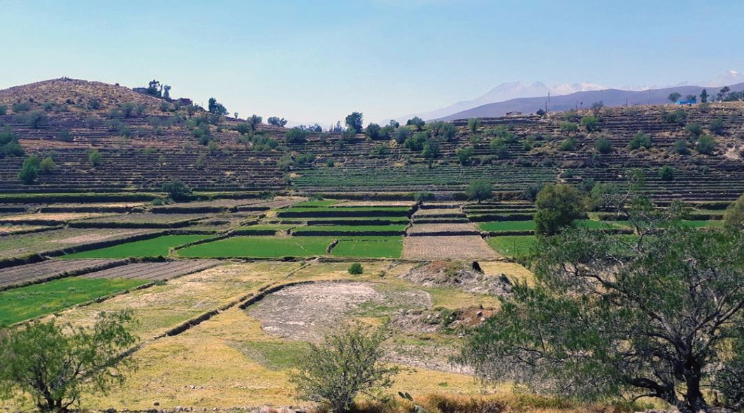
Sabandía has been recognised as a town famous for the gastronomic quality of shrimps that were caught in the nearby river and for the medicinal properties of its waters (Barriga, 1941). For a long time, it was an important spa for the families of Arequipa, due to the presence of its natural baths. Figure 5 shows the terraced landscapes near Sabandía.
The water used to irrigate the Yumina and Sabandía terraces was taken from springs: the ojo de Yumina (eye of Yumina) for the first, and the ojo del milagro (eye of the Miracle) that also supplies the Sabandía sector. These are waters with underground circulation origin and a certain quality. This is why they are demanded for urban use to the detriment of the irrigation needs of the terraces, and this causes a conflict.
Figure 6 shows a representation of the irrigation system detected by satellite images in these sectors. They form a complex distribution system made up of acequias madre or main ditches, from which different acequias secundarias or secondary ditches, ramales and superficial conduits that lead the water to each terrace emerge.
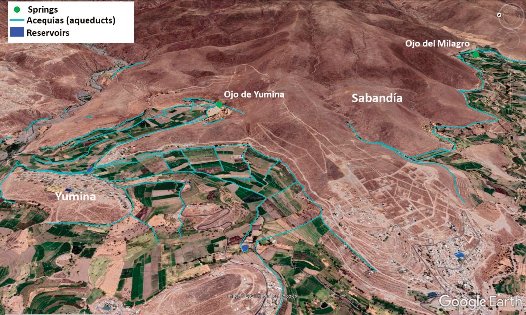
As can be seen, none of them is born in a riverbed except for a small sector. On the north of Yumina, left margin of the Figure 6, we can see the beginning of the canal that gives water to Paucarparta terraces, this one, led from a river through a azud, Champa or diversion dam.
Paucarpata
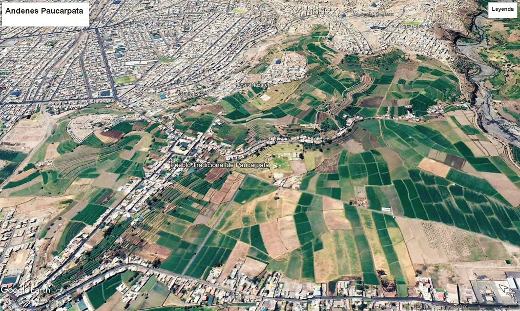
It exhibits one of the most attractive and well preserved platform systems in the Arequipa countryside. In Figure 7 you can see the two prevalent systems of land adaptation: the terraces or leg in the flat parts and the platforms on the nearby slopes. It is presumed that Paucarpata has its name from Paucar, who was the owner chief and for pata which is a Quechua word and means plain.
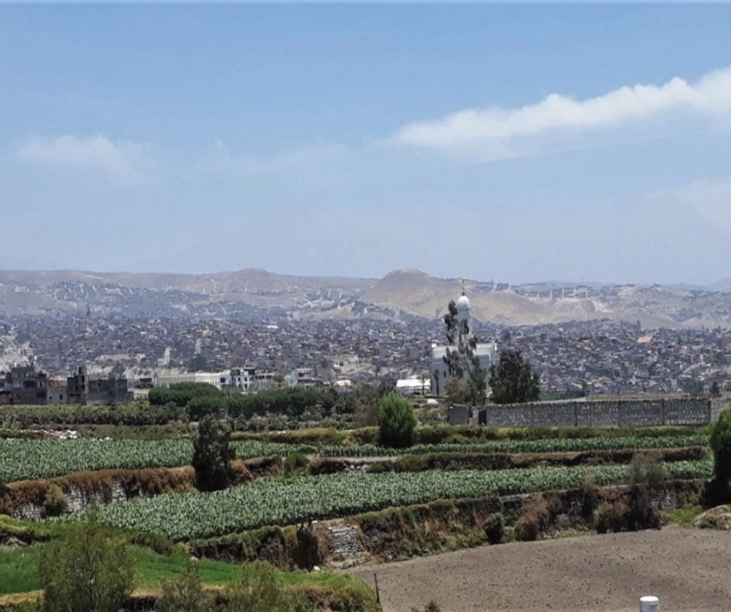
The Chilina countryside Tocrahuasi
It is part of a ravine near the Chilina valley and belongs to the Cayma district, with terraces dedicated to the cultivation of corn, alfalfa, and vegetables (Figure 8). Between the terraces runs the old muleteer path used by the inhabitants of the Colca valley who travelled to Arequipa.
Quebrada de los Tucos
The Quebrada de los Tucos is located in the Cerro Colorado district, on the road from the Cayma district to the airport. It has small plots of individual property, dedicated mainly to the production of alfalfa, for grazing sheep (Figure 9), as well as feeding guinea pigs. Somewhat further away from the city of Arequipa, there are new irrigations in previously desert lands, such as those of the Cural where blocks of ashlar (material for accumulating volcanic residues) are being used in the construction of the terrace’s walls. They are less than 80 years old, and they intensively produce cash crops of onions and garlic, as well as
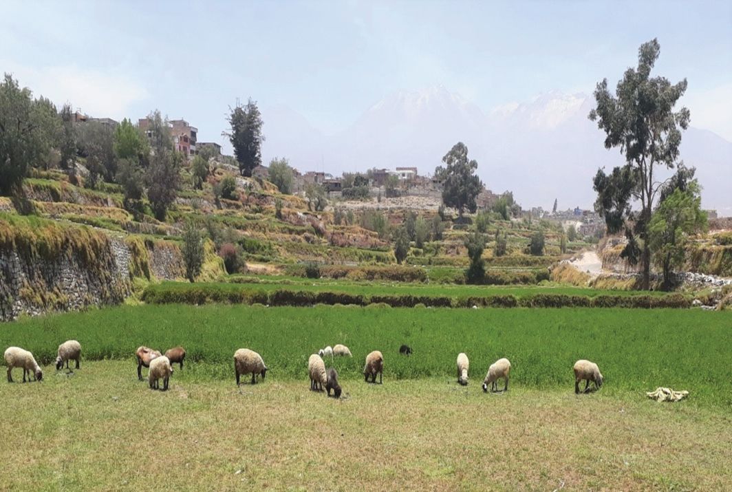
alfalfa for intensive dairy cattle farming.
Agricultural production and agrobiodiversity
There is a close link between the terraces, agrobiodiversity, and food security (Salas, 2015) that is reflected in the crops under the terraces system. In the landscaped countryside around Arequipa there are approximately 900 hectares under the terraces system. Water sources from the Chachani and Pichu volcanoes are used to cultivate the terraces, which also supply water to the city of Arequipa and its districts.
A variety of corn and cucurbits, vegetables and alfalfa are grown and sold in markets. Corn of the chullpi variety and the well known Cayma corn consumed as immature grain, predominate Choclo. The lacayote (cucurbit) associate to cornfields is appreciated, as well as the famous Yumina squash (Figure 10). However, in recent years there has been a change in the production of crops on the terraces, varying to large areas with alfalfa for forage and the cultivation of cabbage, lettuce and different flowers. The diversity of food crops in general has been reduced by the growing demand for alfalfa to feed dairy cattle and guinea pigs and by the change from traditional corn to corn for fodder use.
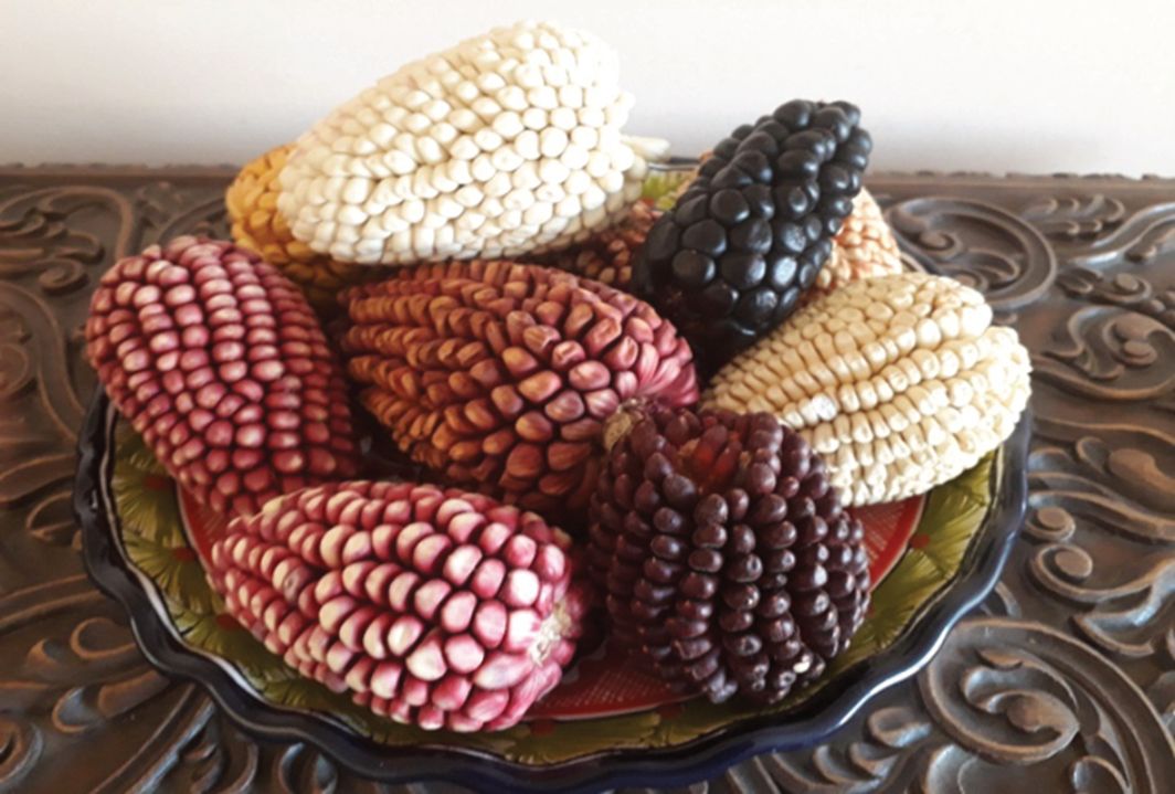
Traditionally, the platforms are surrounded by natural plant species, shrubs, and trees, such as willow. At the edge of the irrigation canals, you will find nasturtium (Tropaeolum sp.), the typical plant of Arequipa that boasts a cheerful orange flower.
At present these areas have been declared as intangible, due to the danger of being converted into urbanization areas, also due to the change in the use of the water that irrigates them (Benavides, 2004), which is happening in the areas of Sabandía, Sachaca and Paucarpata. In general, it threatens the disappearance of the beautiful Arequipa countryside from the plains due to the urbanization process that has occurred in the last 40 years.
The producers
The Culture of Loncco (traditional mestizo families dedicated to agriculture) keeps food and technological traditions and relation with the utilization and maintenance of the terraces. Following the proposal of Love (2005), in which rural and cultural identity is based on the place and its landscape, the relationship between the terraces and their owners, the lonccos, is highlighted. To begin with, it should be clarified that the term loncco is applied to farmers and field workers in the surroundings of Arequipa and that it refers to the mestizo character of the inhabitants of the Arequipa countryside (Lombardi, 2008). However, loncco had its approach to the urban area and its presence is noticeable both in the food markets, as well as in the food traditions, expressed in the stews prepared in the so-called picanterías or traditional food restaurants, where the protagonists are the rocoto and the chilli pepper. They even have a loncco or local dialect, with their own vocabulary that is a fusion of an old Spanish Castellano with their own terms and mixed with some words of Quechua origin. Likewise, musical artistic expressions are part of their culture, such as the yaravíes and the loncco poetry cultivated in the picanterías. The fondness for breeding fighting bulls is omnipresent in traditional families; they are accompanied by their own ritual and respect for the bull, unlike the bloody practices in bullfights.
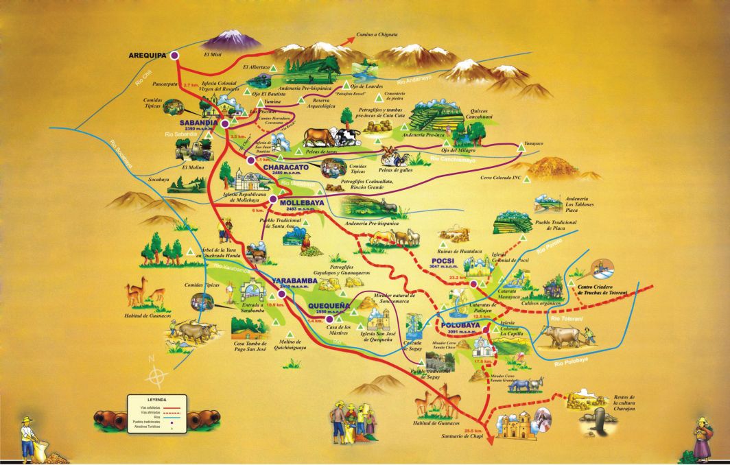
The proposal for a tourist circuit called La Ruta del Loncco (Figure 11) (Bedregal, Martinez, 2008), is identified with the presence of terraces as a visible example of a millenary and living culture. The circuit begins on the edge of the city of Arequipa and has as its axis in the towns that go from Sabandía to Polobaya, passing through Characato, Yarabamba and Quequeña, extending to Chiguata to finally finish at the famous Sanctuary of the Virgen de Chapi. Throughout the tour you can see the terrace systems whose origin responds to the activity of the different Andean ethnic groups that once settled.
Along the route of this circuit, you can see the famous pre-Hispanic terraces of Churajón, the most extensive terraced area but far from the city, that are currently abandoned due to the lack of water for irrigation, in the direction of the Pichu snowfall. The need for the rescue of Churajón is ratified as the important archaeological centre of southern Peru, whose influence covers most of the current province of Arequipa (Cardona, 2002).
4. Discussion
Social aspects
Currently the terraces are privately owned by small farmers organized as irrigation committees for the use of water. Always, and with greater pressure today, the shifts of water use are reasons for conflict. A shift can be given as a privilege each week, usually every 10 to 14 days. The pressure and scarcity on the water have their origin in the increasingly invasive presence of human settlements in the surroundings that require the vital liquid.
Products and marketing aspects
In addition, farmers face problems in the marketing of their products, both due to food competition from other regions, as well as international food imports.
A recent and special interest has developed as a result of the district organization of Sunday fairs where local organic products are offered and where you can buy different types of corn, cucurbits such as lacayote (Cucurbita ficifolia), caigua (Cyclanthera pedata), squash, a variety of vegetables and aromatic and medicinal herbs.
5. Conclusions
The terraces in the Arequipa countryside are preserved thanks to the dedication of traditional farmers and the municipal declaration as intangible areas in the face of urban expansion. However, some areas are already in processes of land use change, which affects their permanence.
The next issue is the conflict over the use of water from the rivers and or from springs, which are the source of irrigation for the terraces, now increasingly derived for urban use, affecting the continuity in the agricultural production of the platforms. One case is that the Yumina terraces, which depend on spring water, are being reduced due to the scarcity of water resources.
Urban expansion has caused many of these canals to be blocked or destroyed, with the consequent loss of the spaces they used to irrigate. Just as when a vein is cut that limb dries up.
With regard to the study and interpretation of terraced landscapes and also of the traditional irrigation systems associated with them, satellite images are very useful, which, although they require work on the ground, have great applications when carrying out an approximation analysis even being able to carry out the system cartography, with the possibility of geopositioning the elements of interest of the system (terraces, reservoir ditches, etc.) in thematic maps, observing all this within the threedimensional visual landscape that these technologies offer us.
Finally the conclusion is that the permanence of the terraces depends on the degree of official valorisation that is given to these traditional systems recognising their importance for soil conservation, food production, as well as the quality of life of their producers and the conservation of the landscape, being the responsibility not only of the current municipal and regional governments, but also of the Ministry of Culture, since the platform systems in the city and province of Arequipa have been declared as Cultural Heritage of the Nation.
References
- Alfaro, J. et al. (1986) Andenería, conservación de suelos y desarrollo rural en los Andes peruanos. NCTL. Ministerios de Agricultura y de Vivienda. Lima: Fundación Friedrich Ebert. Lima, Perú.
- Barriga, V. M. (1941) Memorias para la historia de Arequipa. Relaciones de la visita al Partido de Arequipa por el Gobernador Intendente Don Antonio Álvarez Jiménez 1786-1791. Arequipa: La Colmena.
- Bedregal, J.; Martínez, A. (2008) La Ruta del Loncco. Raíces del hombre arequipeño. Arequipa: Consorcio Identidad y Desarrollo El Taller. Benavides, M. A. (2004) Andenes y riego en el Perú. Un análisis de informes coloniales y republicanos, in Conservación y abandono de andenes. Lima: UNALM, U. de Haifa. Cardona, A. (2002) Arqueología de Arequipa. De sus albores a los Incas. CIARQ. Carpio, J. G. (1990) Arequipa y la Encrucijada del desarrollo 1956-1988. Historia General de Arequipa. Arequipa: Fundación Bustamante de la Fuente. CONCYTEC (1986) Andenes y Camellones en el Perú andino. Historia, presente y futuro. Lima: Ministerio de la Presidencia. Córdova, H. (2004) Ecología cultural de la construcción de terrazas, su abandono y ecuperacón en el Valle del Colca, Arequipa, Perú, in Conservación y abandono de Andenes. Lima: UNALM, U. de Haifa. Denevan, W. M. (1986) The cultural ecology, archaeology and history of terracing and terrace abandonment in the Colca Valley of Southern Perú. Madison: Department of Geography, University of Wisconsin. Donkin, R. A. (1979) Agricultural terracing in the aboriginal New World. Tucson: Published for the Wenner-Gren Foundation for Anthropological Research, inc. [by] the University of Arizona Press - Viking Fund Publication in Anthropology Earls, J.; Silverblatt, I. (1978) Investigaciones Interdisciplinarias en Moray, Cusco, in Etnohistoria y Antropología Andina, pp. 117–122. Lima. Earls, J. (2015) Presentación. Mensaje a mis hermanos y hermanas de los Andes y del mundo presents, in II Congreso Internacional de Terrazas. Encuentro de culturas y saberes de terrazas del mundo, pp. 5–7. Cusco: CBC-JICA. Felipe Morales, C. (1987) La erosión de los andenes en zonas pobladas de altura, Pensamiento Iberoamericano 12, pp. 97–108. Felipe Morales, C. (2004) Balance de las Investigaciones sobre andenes en el Perú, in Conservación y abandono de Andenes, pp. 66–69. Lima: UNALM, U. de Haifa. Galdós Rodríguez, G. (1992) Migración y Estructuralismo en la Etnohistoria de Arequipa. Arequipa: UNSA. Guillet, D. (1990) Andenes y Riego en Lari, Valle del Colca. Arequipa: CAPRODA. Julien, C. (2002) Las Huacas Pacariscas de Arequpa y el Volcán Misti, in Historia N° 5. Arequipa: Facultad de Ciencias Historicas Sociales UNSA. Kendall, A. (1992) Infraestructura agrícola e hidráulica prehispánica. Presente y futuro. Cusco: Cusichaca Trust. Lambruschini, A. (2015) Programa Andenes, in II Congreso Internacional de Terrazas. Encuentro de culturas y saberes de terrazas del mundo, pp. 56–60. Cusco: CBC-JICA. Love, T. (2005) Pequeños propietarios de la Campiña y Usos Políticos del Lugar y el Mestizaje, in Revista de Antropología. Arequipa: UNSA. Masson, L. (1983) Las terrazas agrícolas, una tecnología olvidada en el Perú. Planteamiento para su aprovechamiento eventual. Lima: Banco Continental. Pulgar Vidal, J. (1971) Las ocho regiones naturales del Perú, in Boletín Comité Nacional de Protección a la Naturaleza. Lima. Guaman Poma, F. (1615) Nueva corónica y buen gobierno, in Capítulo 33., de este reino y sus ciudades y villas (1000-1087). Arequipa : La ciudad de Arequipa. Salas, D.; Vásquez, A. (1984) Andenería incaica. Lima: UNALM, Facultad de Ingeniería. Salas, M. A. (2015) Agro biodiversidad, soberanía y seguridad alimentaria y nutricional, in II Congreso Internacional de Terrazas. Encuentro de culturas y saberes de terrazas del mundo, pp. 105–118. Cusco: CBC-JICA. Tapia, M. (1996) Eco desarrollo en los Andes Altos. Lima: Fundación Friedrich Ebert. Tapia, M. (2007) Agro biodiversidad Andina. Lima: Fundación Friedrich Ebert. Tejada, M. (2010) Información personal sobre los andenes de Cotahuasi y la labor de la ONG AEDES. Tillmann, T. ; Bueno de Mesquita, M. (eds.) (2015) II Congreso Internacional de Terrazas. Encuentro de culturas y saberes de terrazas del mundo. Cusco: CBC-JICA. Vega Centeno, I. (2015) Los habitantes de los andenes que rodea a la ciudad del Cuzco actual: Prácticas culturales y agronómicas, II Congreso Internacional de Terrazas. Encuentro de culturas y saberes de terrazas del mundo, pp. 240–250. Cusco: CBC-JICA.
Rights and permissions
Open Access. This article is licensed under a Creative Commons CC BY 4.0 license, which permits use, sharing, adaptation, distribution and reproduction in any medium or format, as long as you give appropriate credit to the original author(s) and the source and indicate if changes were made.
About this article
Cite this article
Tapia, M. E., Fries, A. M., & Novo Negrillo, J. (2020). Arequipa: A City with Terraces in Southern Peru. The Journal of Terraced Landscapes, 1(1), 86–105. https://doi.org/10.5281/zenodo.5819569
- Published
- October 2020
- Issue
- Volume 1, Number 1
- Journal
- The Journal of Terraced Landscapes, ISSN 2754-7612 (Online)
- Archive
- Zenodo record 5819569
- Arequipa
- terraces
- traditional farmers
- crops
- risks