
Saving a steep slope relict vineyard landscape through an integrated model project of land consolidation in the Lower Lahn Valley
Affiliations
- 1 Service Center Rural Area Westerwald-Osteifel in the state of Rhineland-Palatinate
The Journal of Terraced Landscapes volume 2, issue 1, pp. 8–37 (2026) · Cite this article
- 115 views
- 89 downloads
- DOI10.5281/zenodo.18375879

Abstract
With the model project of land consolidation in Rhineland-Palatinate, which was launched in 2012, an integrated planning approach made a significant contribution to the preservation and design of a steep-slope relict growing area in the last two steep slope municipalities of Obernhof and Weinähr an der Lahn in the Middle Rhine wine-growing region. The interests of viticulture, nature conservation and tourism were brought together in an exemplary manner. The bottom-up approach is pursued, in which various project and financing partners work together across municipal boundaries and use various rural funding instruments.
Keywords
- Citizen participation
- steep slope viticulture
- integrated planning approach
- dry stone walls
- land management
Introduction and Background
Relict Vineyard Landscape Lahn
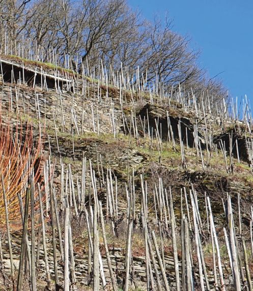
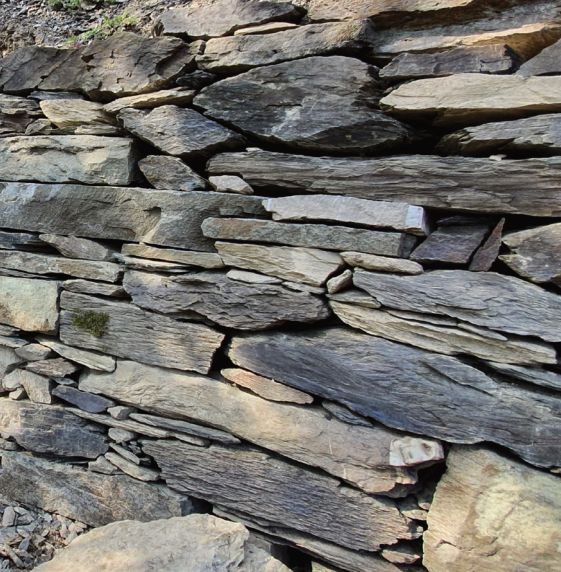
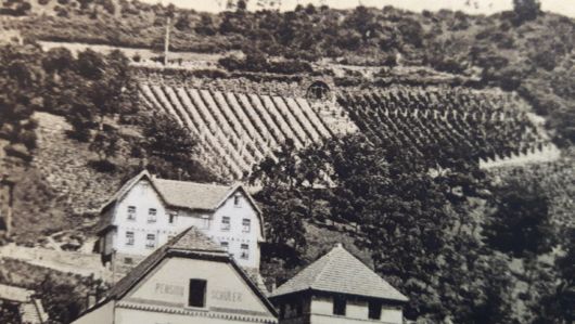
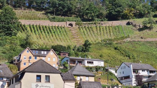
Viticulture on the Lahn can look back on a history of more than 800 years. For many centuries it was an important economic factor and shaped the landscape and people with its maximum extension of up to 200 hectares in the 16th century. Especially in the lower Lahn valley, which is cut more than 200 m deep into the Rhenish Slate Mountains, terraced viticulture shaped the landscape with its slate dry stone walls, staircases, rock outcrops, stone harvest heaps and greywacke vineyard huts on the steep slopes facing south (Fig. 1). Due to the locally occurring flat greywacke, the “fish pattern” is traditionally shown in the “face” of the dry stone wall typical of the region.
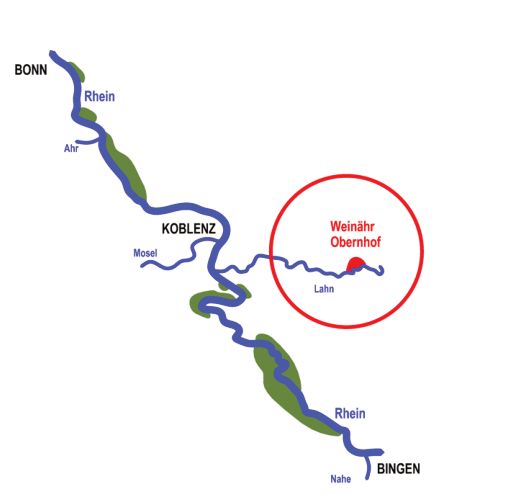
The growing area became famous for its central role in the fight against phylloxera, which appeared from the end of the 19th century. Phylloxera could not establish itself in the Lahn Valley and was therefore an ideal location for state testing until the 1960s. In addition to many pruning gardens and model vineyards, the Prussian Rebveredelungsanstalt was founded in Oberlahnstein in 1910, which in 1925 rose to become the largest institution of its kind in Germany and left architectural traces in the landscape here. In 1971, the Lahn wine-growing region, which had become inconspicuous, was incorporated into the Middle Rhine region with about 10 hectares of cultivation area at the time. (Fig.2)
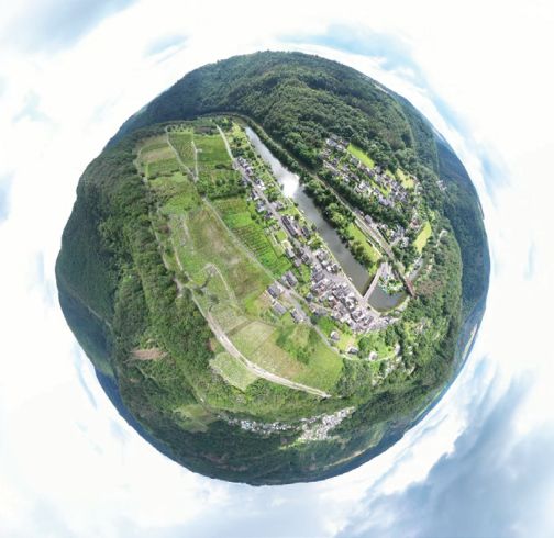
As a visitor today, there is not much left to see of the historic wine-growing landscape. Forest and isolated rocky outcrops characterize the valley again. However, if you look under the forest cover, you will still find many remnants of the former wine-growing landscape, as there was no over-formative successor culture here. Only 5.3 hectares of vineyards with 5 wineries and 7.5 km of vineyard walls are now relict cultivation areas in the wine villages of Obernhof an der Lahn and in the adjacent Weinähr am Gelbach. The labour difficulties with the high amount of manual labour in the steep slopes, as well as a secluded, almost forgotten rural area, ultimately led to one of the smallest contiguous wine-growing areas in Germany. The fact that the Lahn wine survived is ultimately due to the tourism that began in the 50s and 60s, which went hand in hand with the marketing of the now rare Lahn wines, and to a first land consolidation in the 1980s.
Starting situation
The historically shaped wine-growing landscape of the last two wine-growing towns of Obernhof and Weinähr is approx. 87 hectares. Today, more than 90% of these lie fallow and are mostly forested. The remaining vineyards form a mosaic of vineyard terraces, areas cultivated in the direction of slope and largely by hand, fallow and wooded areas and dry-stone walls. Steep slopes of 50 to a maximum of 78 % are reached. The five remaining wineries market their wines almost exclusively via direct marketing to customers. The demand for the rare Lahn wine exceeds the supply. However, the current bottle price does not adequately reflect the economic necessity in the still predominantly historically cultivated, property-fragmented steep site. For the survival of the farms, adjustments in modern cellar management, an increase in acreage, consolidation of vineyards, infrastructure, marketing and a significant improvement in the mechanical cultivation of the steep slope are necessary soon.
In Rhineland-Palatinate, the Lahn Valley, together with the other steep-slope winegrowing regions of the Middle Rhine Valley, Moselle, Nahe and Ahr, is of extraordinary importance for rare and highly endangered heat- and drought-loving animal and plant species. Many of these species reach their north-eastern distribution limit in the Lahn Valley. Due to the heavy bush encroachment following the abandonment of the vineyards, the habitats of characteristic species of the dry biotopes, which depend on extensive areas with little or no vegetation, disappeared. The current cultivation of the vineyards with the current cultivation recommendations, the widespread uniform use of machinery and the neglect of the maintenance of the vineyard walls leads to further restrictions for many of these specialised species. Remnants of the typical vineyard fauna are still present with wall lizard, smooth snake, blue-winged wasteland grasshopper, butterfly, wine crest, rock diver and ant lion. In Obernhof is the last pair of Rock Bunting on the Lahn. The last terraced vineyard on the Schreiberley, the open vineyard walls along the farm roads and an exceptionally thick 2,500 m² stone harvest pile (called “Steinrassel or Steinriegel”) in the Lahn Valley is a hotspot of this biodiversity. A further abandonment of the wine-growing areas or cultivation that runs counter to nature conservation would be the end of the accompanying typical flora and fauna in a few years. The tourist offer in the Lahn Valley has so far concentrated on the activities directly on the river. The Lahn has been one of the most popular rivers for water hiking in Germany for decades. An accompanying long-distance cycle path and the Lahn hiking trail with its arrival and exit options via the parallel Mayen-Wetzlar railway line successfully complement these efforts. Heavily frequented campsites and increasing motorbike tourism are increasing the flow of movement in the narrow lower Lahn Valley. Due to the progressive forestation, however, the visitor hardly notices the former wine-growing landscape. In the last two wine-growing towns of Obernhof and especially in Weinähr, forestation is also increasing and accommodation, restaurants and wine bars are steadily decreasing. Only now, attractive tourist offers and impulses related to the wine-growing cultural landscape and the expansion of wine-growing areas can avert the trend reversal.
The Integrated Model Approach
Conception
The Lahn relict wine-growing region has an exceptionally high development potential for viticulture, nature conservation and tourism. It is a gem away from the well-known vineyards on the Middle Rhine and Moselle and is generously equipped with unique selling points. The region’s economic and environmental prospects are very promising. The model project of land consolidation aims to bring together the exceptionality, the beauty and the rarity of the still existing elements of the relic wine-growing landscape, the requirements of the strictly protected species, as well as the prerequisites for modern, sustainable viticulture in an integrative way and sustainably. The small-scale nature of the landscape and the historic wall elements are to be preserved, supplemented or redesigned as far as possible, despite modern mechanical viticultural cultivation. Necessary compensation areas according to nature conservation law should be sensibly interspersed in the cultivation areas and should also be managed as completely mechanically as possible. In order to increase the wine-growing area from 6 hectares to 15 hectares, former already bushy and reforested sites must be converted to make them suitable for viticulture. This change of use is subject to compensation under nature conservation and silvicultural law. A legally binding link between the new wine-growing area and the associated compensation area is to be sought. Due to the sensitivity of the rare animal and plant species and the large-scale redesign of the landscape, ecological construction supervision and a monitoring programme to check the effects with a follow-up of measures will be necessary.
The Lahn Valley is considered one of the most undiscovered regions in Rhineland- Palatinate. Not far from the conurbations of Koblenz, Frankfurt and Cologne, this is a real insider tip for tourism. For the nearby World Heritage Site of Bad Ems, the Lahn wine is an important unmistakable trademark with radiance for the entire region. To increase the number of visitors again, new impulses for tourism are urgently needed. Only an offer that has an impact beyond the region is forward-looking. The combination of innovative external services and an active grassroots participation of the citizens from the region are intended to show new ideas here.
The need for financial and content-related support is very great in the region. Added value can only be achieved through the integration and bundling of the various rural support instruments. Due to the high construction, approval and funding requirements, experience in the German funding landscape together with moderation tasks and citizen participation is indispensable as a key building block. Land consolidation can play a central role here and, with its own specialist staff, can take on supporting tasks for the responsible municipality.
Approaches to solutions in rural development
Rural development in Germany aims to preserve and promote rural areas as an economic and social area. Various instruments and measures are available for this purpose, which are described in the “Guidelines for Rural Development” of the federal state working group “Sustainable Land Development” (see https://www.landentwicklung.de/ziele/leitlinien-2011). The model project in the municipalities of Obernhof and Weinähr primarily addresses the areas of integrated development concept, LEADER, land consolidation, nature conservation, rural infrastructure and tourism. On the initiative of the winegrowers, the project “Sustainable structuring of viticulture on the Lahn” was launched in 2008 as part of the Integrated Rural Development (ILE) Lahn- Taunus. This project opened the possibility of securing viticulture on the Lahn for future generations on the one hand and improving networking with other existing or emerging projects on the other hand. Based on this, the Westerwald-Osteifel Service Centre for Rural Areas (Dienstleistungszentrum Ländlicher Raum (DLR) Westerwald-Osteifel), as the responsible land consolidation authority, prepared a project-related study (PU), the results of which were incorporated into the Obernhof-Weinähr land consolidation procedure initiated in 2012
Land Consolidation Procedure Obernhof-Weinähr
Land consolidation in Germany is an officially led procedure for the reorganisation of rural properties. According to the Land Consolidation Act, various goals can be pursued, such as the improvement of agricultural production conditions, the preservation and promotion of the cultural landscape, the protection of nature and the environment, the development of rural areas and the safeguarding of property. The land consolidation comprises various measures, which are described in detail below, based on the Obernhof- Weinähr procedure.
Space management
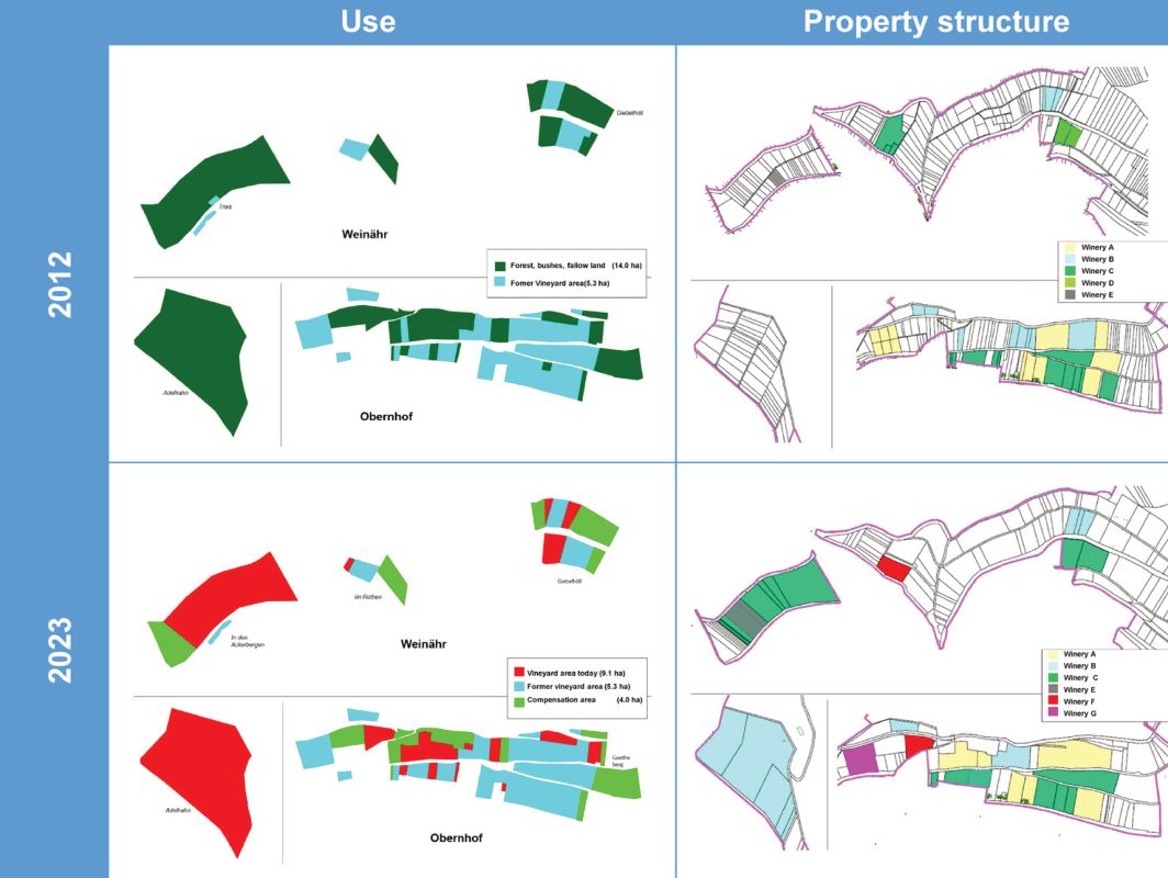
Land management is the central task of land consolidation. It includes the recording, valuation and redistribution of the plots of land, considering the wishes and interests of the owners and tenants. To counteract the management task and thus the loss of viticultural, nature conservation, landscape aesthetic and tourist value, a new use and development concept was developed in coordination with the state conservation goals, which also considers the prerequisites for mechanical cultivation in cable or direct trains. The different demands on the use of the landscape could be harmoniously combined here by creating a balance between the interests of viticulture and the interests of species and biotope protection as well as the preservation of the traditional landscape. During the redesign of the process area, larger cultivation units were formed in the vineyards and the area under cultivation was almost tripled. In 2012, seven wineries shared a vineyard area of 5.3 ha, and in 2023 after the merger, six wineries shared a vineyard area of 15 ha. In addition, there are 4 hectares of open-land compensation areas (see Fig. 3). This means that today’s open cultural landscape, which is dominated by viticulture, will once again reach 19 hectares in use. Of the historically shaped wine-growing landscape in Obernhof and Weinähr, about 21% have thus been made viticultural sustainable again and are visible again in the landscape.
Measures
The planning of all measures was worked out together with the board of the participating community (TG) and the planning approval for the construction of the measures as well as the modification, relocation and confiscation of existing facilities was prepared. The board is elected by the participants in the land consolidation as a representative of all owners. The involvement of this body ensures that all local concerns are considered. Finally, the planning approval of the structural and design measures establishes the admissibility of the projects about all public interests affected by them. In addition to planning approval, other official decisions, in particular permits, permits and permits, are not required. The planning approval regulates all public-law relationships between the developer of the project and those affected by the planning in a legally structured manner. Public concerns, such as the preservation of the landscape or biotopes, are also considered.
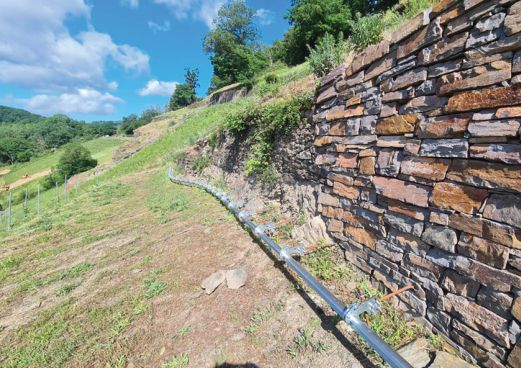
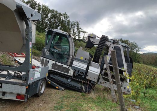
The structural and design measures carried out as part of the land consolidation are referred to as investment measures. They serve to improve the agricultural infrastructure, enhance the cultural landscape and promote nature and environmental protection. The integral land consolidation procedure is therefore a very powerful instrument for the implementation of complex land planning projects.
With a few exceptions, the process area was sufficiently developed by main farm roads that were predominantly paved with bituminous pavement. However, in view of the increased use of crawler mechanisation systems (RMS) for the cultivation of vineyard areas planned in the future, improvements in the development of the vineyards were necessary. For this purpose, mainly grass paths were newly created or expanded on existing lanes. Most of the cultivated areas have been developed with paths in such a way that the RMS can be used by a special trailer with an associated tractor running above the rows of vines. This also applies to some of the compensation areas. However, some areas were not accessible in this form, so that the installation of safety rails (a total of 280 m) including the necessary operating stairs above the rows of vines was necessary for the RMS. (see Fig. 4)
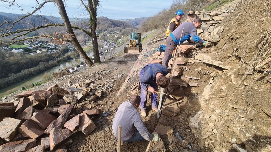
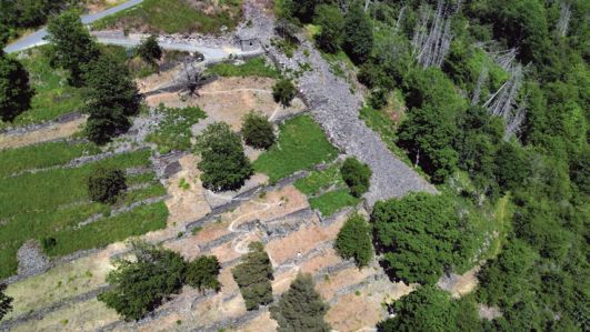
In addition, along many sections of the path on the valley side and partly also on the mountain side, retaining walls made of natural stone dry masonry, with a height of up to 4 m, were in danger of collapsing and therefore urgently needed restoration. In some cases, sections of the Wall had already completely collapsed and had to be rebuilt. Many crowns of walls that were basically still stable also showed damage that had to be repaired. The required new stone material (greywacke) was selected according to colour, structure and format, with special consideration of the existing natural and landscape image.
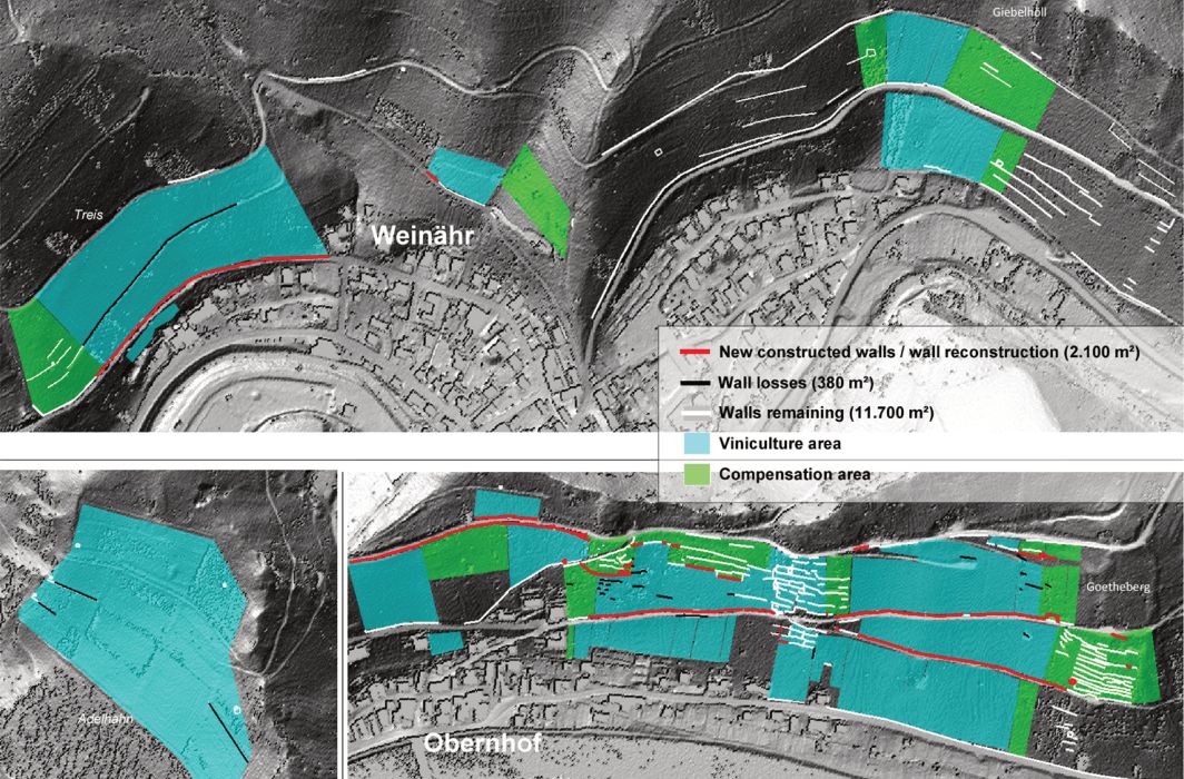
With the new construction or restoration of approx. 2,100 m² and the release of 4,000 m² of dry-stone walls, a significant contribution was made to the preservation of these individual elements that characterise the landscape (see Fig. 5).
Another extensive package of measures is the production of the areas used for viticulture. As part of the land consolidation, the vineyards were redesigned to enable optimal cultivation in the future. All new vineyards and the compensation areas were newly planted on former vineyards, some of which were heavily forested and fallow. Grading was carried out only to a very limited extent to remove obstacles to the future mechanical cultivation of the vineyards or to maintain the compensation areas and was mostly related to the removal of walls (see Fig. 6). The old walls in these areas, usually up to one metre high, were demolished where necessary and levelled in the area. Usable stones from the removal of walls were reused in the construction of walls.
The necessary change of use from forest, bushes and fallow land to new vineyards as well as the removal of vineyard walls and the construction of paths are subject to the intervention regulation and must be compensated for in accordance with applicable nature conservation law. In addition, species protection requirements must be considered in the planning.
For the change of use, a total of 4 hectares of compensation areas in the form of fallow vines and orchards had to be implemented by the TG. After five years of furnishing maintenance, permanent maintenance is expected to be handed over to a person liable for maintenance from 2025. For this purpose, a legally binding linking and allocation of the new vineyard area (private owner and using winegrower) and compensation area (usually owned by the local municipality) is carried out as a model. Here, sustainable maintenance of the target biotope is guaranteed as long as cultivation takes place on the new vineyard area. All other structural changes were compensated for by the restoration or new construction of vineyard walls and vineyard huts.
Since 2018, ecological construction supervision has been taking place, including a monitoring programme to check the effects. This resulted in additional follow-up measures during the construction work. The planting of flower fringes made of certified seeds from the region along the wall heads and wall feet, including a sustainable care concept for the neighbouring farmers and the local communities, are particularly noteworthy here. The monitoring of the specified construction time windows and the adaptation of these specifications to the local conditions is another important task. The production maintenance of the compensation areas will also be further reviewed until it is handed over to the maintenance party and, if necessary, further optimised ecologically and economically. The greatest challenge for the ecological construction supervision, however, was the structural improvement in the construction of the wall or the construction of new walls from the point of view of species protection for the strictly protected small population of the wall lizard, which lives here at its distribution limit.
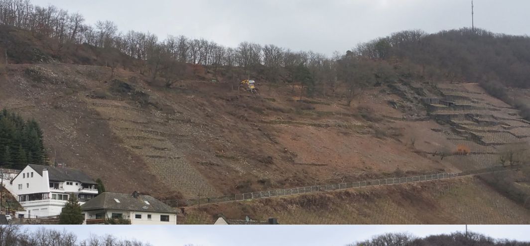
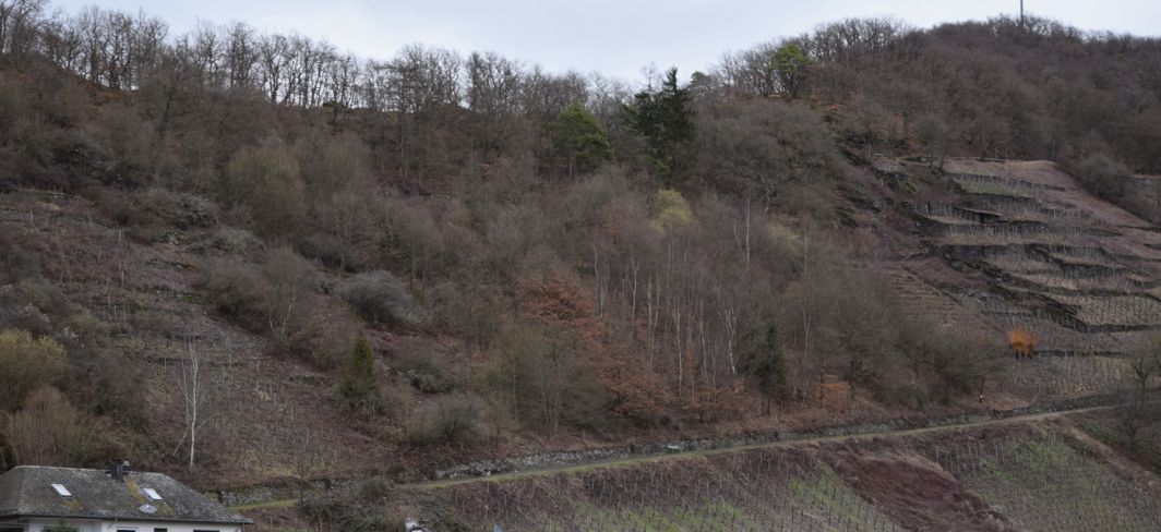
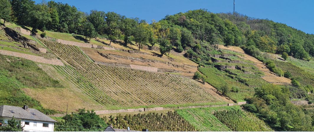
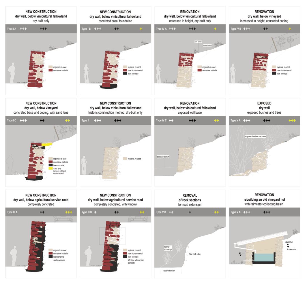
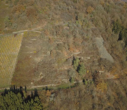
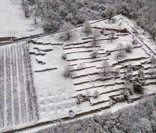
During the implementation, various locally adapted solutions were implemented in cooperation with the ecological construction supervision in wall construction to meet the different demands on economic efficiency, nature conservation and landscape (see Fig. 7).
The high increase in area of exposed, restored and newly rebuilt dry-stone walls and the enlarged mosaic-like flower-rich open land area showed the first successes for species protection shortly after the construction measures. Many strictly protected heat- and drought-loving species (e.g. smooth snake, sail butterfly, blue-winged grasshopper, praying mantis, ant lion) were able to spread over the area and in some cases record large population increases. The last rock bunting occurrence in the Lahn Valley could be maintained, and further breeding attempts have already been observed in other places. The wall lizard also shows an expansion into the many newly created habitats. Particularly pleasing was the rapid recolonization of the oldest terraced site in Obernhof from the 1860s, which was uncovered in 2020 (see Fig. 8). In the land consolidation planning, quantitative and qualitative improvements for existing and new hiking trails in connection with other funding projects (LahnWeinStieg, Lahnwanderweg and Gelbacht-Trail) could be considered. Here, missing connections were created in an attractive route and expansion quality with many new experience highlights as part of the land consolidation. The merger of the last two wine-growing towns has thus received a very decisive boost in the perception of the visitors. The largescale removal of trees has cleared many historical landscape elements such as vineyard walls, vineyard huts and stone depots. They were processed in terms of content, partly rebuilt and prepared for later funding projects.
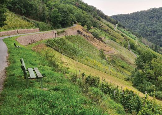
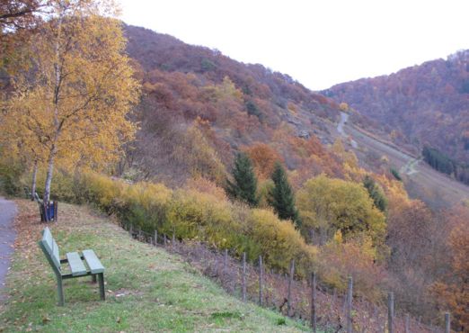
Many new sightlines, vantage points and landscape sub-spaces were created for the visitor (see Fig. 9). The nature conservation efforts in biotope and species protection and especially the new abundance of flowers on the paths and wall edges as well as on the compensation areas are particularly noticeable to the visitor. The perception as an independent, open wine-growing landscape with exciting stories and the very special natural features is showing its first successes. The Lahn-Taunus tourism region is once again increasingly focusing on the last two wine-growing towns on the Lahn in its external presentation and offer. The quality, the special feature and the rarity currently contribute to the fact that the region is a real insider tip with a rapidly increasing number of visitors.
Execution work
A large part of the expansion work was carried out by the Association of Participating Communities (VTG) itself. For this self-directed work, the association has specialist construction workers, measuring assistants, machine operators and construction supervisors at its disposal throughout the country. The machinery and equipment include self-propelled machines and construction equipment. Due to the many years of experience of VTG’s workers and their specialisation in land consolidation work, VTG’s own management work is an integral part of the implementation of land consolidation procedures. In the Obernhof-Weinähr land consolidation procedure, only a few measures (e.g. rock stabilisation measures with rockfall protection nets and clearing work), for which the VTG’s existing machinery is not designed, were awarded to external companies. The work on the vineyard walls was carried out almost exclusively by experienced VTG employees who have been working exclusively on them for many years in the vineyard land consolidation (see Fig. 10). This work is monitored as part of the official construction supervision of the land consolidation authority in conjunction with ecological construction supervision.
Costs and financing
The costs and financing of the land consolidation depend largely on the scope of the planned measures. The personnel and material costs of the authority organisation are borne entirely by the state of Rhineland-Palatinate. The processing team at DLR Westerwald-Osteifel in Montabaur is made up of qualified personnel from various departments (surveying, construction, landscape management and administration). 90% of the expenses for the construction of the common facilities, as well as the material and non-official wage costs incurred in the surveying, marking and valuation of the parcels, are covered by grants from the federal government and the state of Rhineland-Palatinate. The remaining 10% of the costs are borne by the local municipalities of Obernhof and Weinähr as well as the active winegrowers. The project costs up to the present time amount to around € 3.2 million.
Integrated Funding Projects
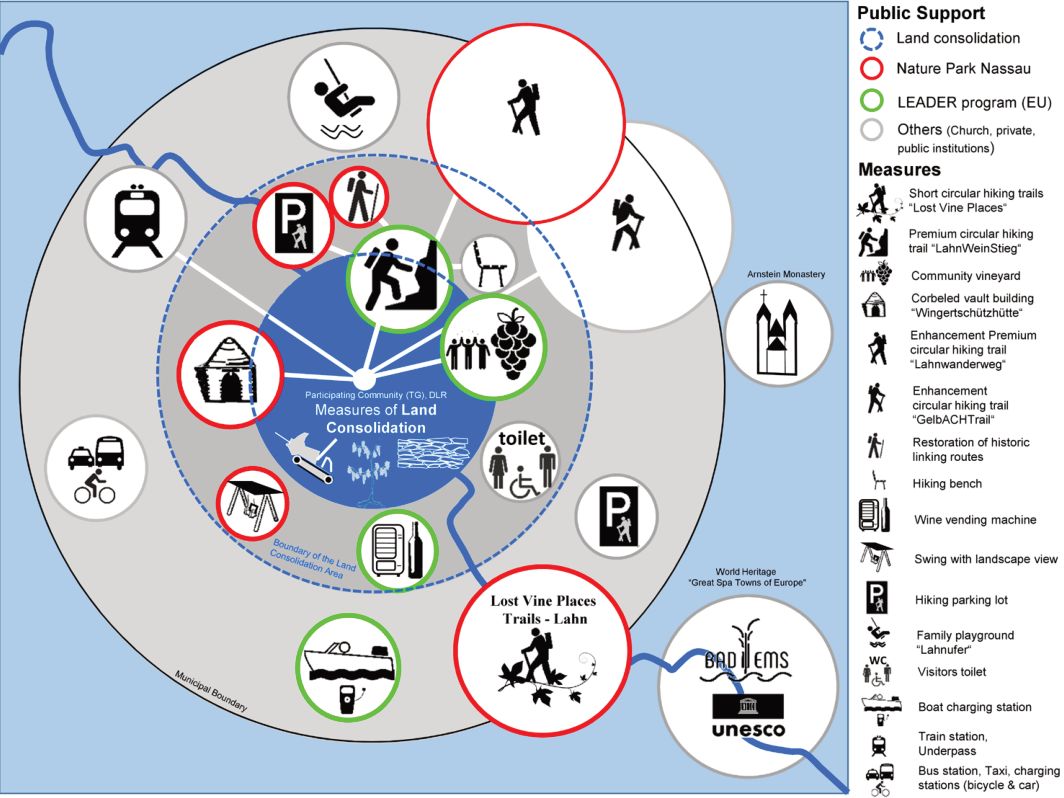
In addition to land consolidation, other funding instruments from the European Union, the federal government and the states are available in rural areas, which, if optimally combined and supplemented, can achieve an enormous financial and substantive advantage for the entire region. In addition, there are other projects resulting from the legally enshrined nature conservation compensation obligation. Land consolidation is suitable as a central integrated planning instrument here (see Fig. 11). The integrated LEADER and Nature Park projects are presented below. Projects that contribute to the further upgrading of the district, mainly without direct participation of the land consolidation, are, for example, the installation of a wine vending machine in Weinähr, the construction of a new guest toilet and the construction of a landscape swing on the LahnWeinStieg. In Obernhof, it is the Lahnufer family playground, the redesign of the train station and the new installation of the electric boat charging stations on the banks of the Lahn. In addition, there is the construction of dry-stone walls as a compensation measure for construction work by Deutsche Bahn. In the neighbouring community of Seelbach, the financially complex restoration work in the nearby pilgrimage site “Kloster Arnstein” is having an effect. In addition, there are various funding measures in the district town of Bad Ems as a UNESCO World Heritage Site “Great Spa Town of Europe”.
Leader
LEADER stands for “Liaison Entre Actions de Développement de l’Économie Rurale”, i.e. the combination of actions for the development of the rural economy. LEADER is a methodological approach to regional development: it enables people in rural areas to develop their region together. This approach has been used in EU Member States since the 1990s. In the new EU funding period from 2023 to 2027 www.netzwerk-laendlicherraum.de/dorf-region/leader/leader-kurz-erklaert/, there are 372 LEADER regions in Germany; almost 2700 across Europe. Obernhof and Weinähr are in the LEADER region “Lahn-Taunus”. The following LEADER projects were implemented within the framework of the old LEADER funding period 2014-2020 (extended until 2022):
LahnWeinStieg
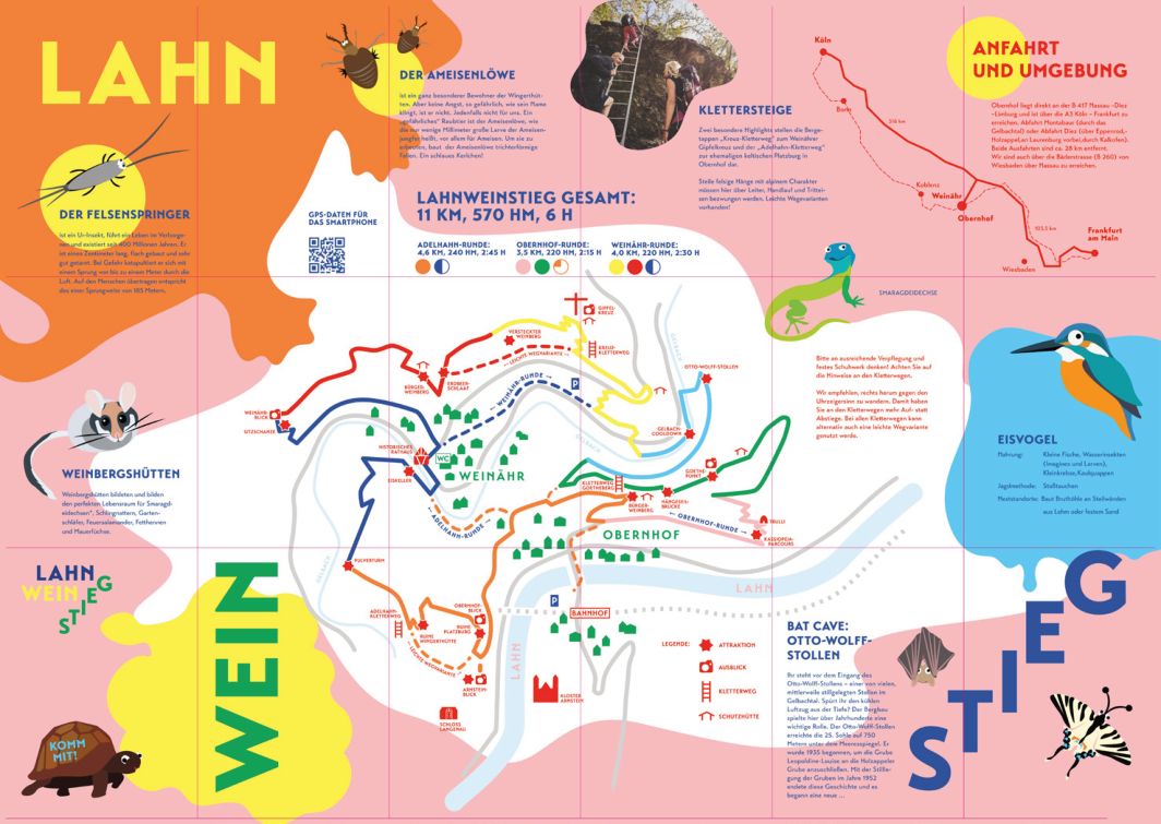
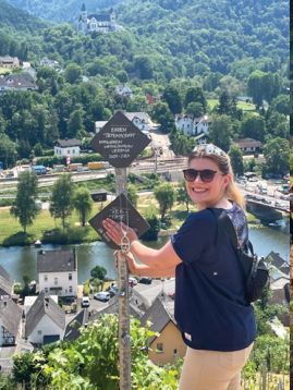
The cross-community Lahn-Wein-Stieg is designated as an approx. 11 km long dream tour (certification and signage according to the criteria of the German Hiking Association). With the help of a new type of information transfer and trail equipment, the wine-growing tradition and the cultural landscape are to be made accessible to tourists in an eventful way. The hiking trail is intended to make the region, its history and, above all, the Lahn wine better known. A varied mixture of hiking, landscape, culture, wine and enjoyment is intended to provide guests with a beautiful overall experience (see Fig. 12).
The Lahn-Wein-Stieg with its 570 meters of altitude can be walked in one hike in about 4-6 hours. The path is classified as a difficult route for hikers. It is also possible to divide it into three individual circular tours: Adelhahn (4.6 km), Weinähr (4 km) and Obernhof (3.5 km). The easy to moderately difficult climbing passages (Adelhahn, Gotheberg, Gipfelkreuz) pose three special challenges. A variety of views of the Lahn and Gelbach valleys and 31 adventure stations including 6 installations along the route with topics on viticulture, nature conservation, mining, fruit growing, ice cellars, Gelbach, timber transport, building culture and Goethe (see Fig. 13) provide variety.
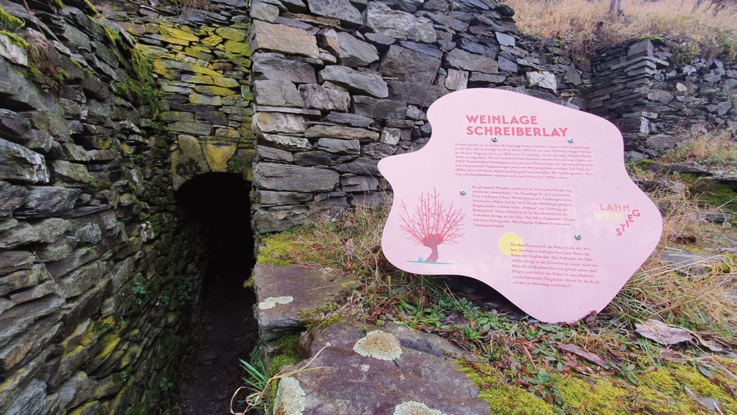
The new information transfer and route equipment (design, scenography, architecture, infotainment, manual installation), signposting and certification are funded by the Lahn- Taunus LAG. The costs for the accompanying concept planning, including the implementation of workshops, as well as the “story building” used for the first time for hiking trails and the construction of the paths and paths, will be funded almost entirely from land consolidation funds. Only the section of the “Adelhahn-Steig” that runs outside the land consolidation area is financed by the Nassau Nature Park and Touristik Bad Ems-Nassau. Today, the LahnWeinStieg is one of the top hiking trails in the region, connects the two wine villages sustainably and attracts tourists and wine lovers from near and far. It receives the best ratings from visitors and is also very well received by families with children. It has already become the flagship of the Lahn wine-growing region.
Citizens’ vineyard
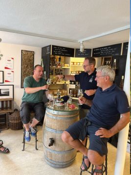
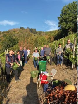
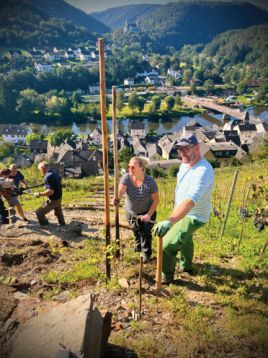
As part of the Citizens’ vineyard project, a citizen participation model is being developed for the cultivation of two historic vineyards. The idea was born in 2018 on historic wine-growing sites in Obernhof and Weinähr and was tested and implemented across municipalities between 2020 and 2023 with the help of the LEADER project “Model Project Citizens’ Vineyard”. In order to determine a suitable form of organisation and participation as well as a perspective for further economic development, external scientific support was consulted during the project. This resulted in the organizational form “geweinschaft e.V.” in 2021. Everyone interested in wine now can participate in the project. This can be to join as a sponsor of vines or as a member of the association. For both forms of support, active work in the vineyard is desired. Part of the work is carried out by the members, the work with the use of machinery by a contractor. Today, the Citizens’ vineyard is mainly financed by the sale of its own wine production, by sponsorship and membership fees and by the proceeds of educational work on the Lahn wine cultural asset. The “Vinovent” information centre in the centre of Obernhof serves the association as a starting point for hikes and courses. These rooms are available to visitors for wine tastings at weekends during the main tourist season (see Fig. 14). The project now has 2,750 newly planted vines on two sites with a total area of around 6,000 m² and two new vineyard huts built according to historical models. So far, the areas have been actively looked after by two paid viticultural experts, the so-called Wingertschützen. In Obernhof, a historic pruning garden from 1905 of the then Royal Institute for Fruit and Viticulture in Geisenheim was restored with modern cultivation conditions (see Fig. 15). In the sense of a test facility, PIlzWIderstabil grape varieties and individual old table grapes are grown here. The first wine of the new vines was harvested in 2022. On a vineyard site that has been known for centuries, another modern vineyard with two PIWI varieties was built in Weinähr in 2021. The first wine could already be tasted from the old vines in 2021. The main varieties in both vineyards are “Souvignie de gris” and “Cabernet Cortis”. In 2023, the Geisenheim University of Applied Sciences - Institute for Vine Breeding, as the successor organization to the old school, provided the project as a historically connected partner organization with 75 historic vines in 10 different grape varieties that stood in the original pruning garden in Obernhof. These are the historic vines: White Heunisch, Yellow Orleans, Lambert grape, Medoc, Milton, Muscat St. Laurent, Chasselas musqué, Orange grape, Gold Riesling, Grüner Veltliner). Further information can be found on the project homepage www.geweinschaft.de.
Nassau Nature Park
The Nassau Nature Park is a national protected area and one of nine “National Natural Landscapes in the State of Rhineland-Palatinate”. As a special-purpose association of the two districts of Rhein-Lahn and Westerwald, the nature park is a purely non-profit institution and supports measures in the areas of land conservation, nature conservation and nature-friendly tourism. The project funding of the nature park contributes to the implementation of the action programme. (www.naturparknassau.de). Project funding plays an important role in the development of these goals in the region. Here, the initiative of local citizens is essentially supported in manageable, mostly smaller, unbureaucratic projects. Overall, this funding instrument is an ideal partner for the integrated approach. In connection with the land consolidation, two funding projects related to and supplementary to the LahnWeinStieg and the local history of viticulture should be mentioned. They ideally complement the nature conservation and tourist destinations:
Trails
The premium long-distance hiking trails “Lahnwanderweg” and the premium circular hiking trail “LahnWeinStieg” were conceptually and in terms of planning integrated into the land consolidation procedure. Small sections of these hiking trails were outside the land consolidation area and were funded by the nature park at the request of the local communities. These are measures to restore historical paths, which Johann Wolfgang von Goethe already rode with his donkey cart on his Lahn hikes in 1774. The installation of a landscape swing, a climbing passage and the preparation of a new hiking car park complete the hiking trails.
Wingertschützhütte Obernhof
In the land consolidation, large areas of historic wine-growing areas were freed up. In addition to wall relics, many ruins of the former Wingerthütten also came to light. In cooperation between the nature park, the local municipality and the land consolidation authority, these buildings were then mapped, measured and further historically processed. A total of about 40 buildings could be recorded in both districts. Its history of origin is recorded in the 1920s/1930s. Two of these huts, which are still preserved in the foundation walls, are attributed to a year of origin from the second half of the 20th century. They served the so-called Wingertschützen or Flurwächter as a shelter, which was supposed to prevent grape thefts and drive away birds, among other things. One of these huts was built in the 1860s in connection with the oldest vineyard terrace in Obernhof, which still exists today. It is assumed that this is an unusual building construction for the Lahn Valley with a cantilever dome roof made of stone without mortar. This makes this hut one of the oldest known buildings in the vineyard around Obernhof and Weinähr and a nationally valuable figurehead for the history of viticulture on the Lahn. With the reconstruction, the local municipality of Obernhof wants to make this historic site directly on the premium hiking trail “LahnWeinStieg” accessible to tourists again. At the same time, the special construction of the hut in dry stone wall construction with many gaps and crevices between the stones creates a habitat for wall lizards, for example.
The reconstruction of the 4x4m Wingertschützhütte could be implemented in the first half of 2023 with financial support from the nature park and planning and organisational support from the land consolidation authority (see Fig. 16). Mostly on weekends, stone on stone was placed by volunteer, mostly experienced dry stone wall builders and helpers from the region until the foundation wall, which was over two meters high, was completed. Construction was carried out without the use of major machines.
At the beginning of May, the roof construction in cantilever dome construction was then in-structed by two experts from the Dry-Stone Wall School of Austria from the Wachau. Here, too, the use of machines was completely dispensed with. Stones weighing up to 320 kilos were hoisted to a height of three metres via a ramp, in the manner of a pyramid building, so to speak.
In the end, there were about 85 tons of stones in 1,400 hours of helpers, all of which were dragged and set by hand. It is assumed that such a structure in the Federal Republic of Germany, in this way, i.e. without formwork, freely bricked and without the use of mortar or plaster, has probably not been built for 100 years. The project shows the high level of commitment of the local people to the winegrowing tradition and at the same time highlights the project as a milestone in the preservation of this ancient craftsmanship.

Summary and Final Evaluation
In the land consolidation procedure, the existing vineyard area was expanded from 5.3 ha to 15 ha plus 4 ha of fallow vines as compensation areas with corresponding infrastructure. For the use of crawler mechanisation systems (RMS) for the cultivation of vineyards, 280 m of safety rails including the necessary operating stairs as well as new and improved farm roads were created. Mechanical cultivation is now possible on almost all vineyards. Two historic terraced sites were preserved or freed from woody plants. With the new construction or restoration of approx. 2,100 m² and the clearance of 4,000 m² of drystone walls as well as the reconstruction of two Wingert huts, essential landscape-shaping individual elements could be made visible again. The costs of the land consolidation procedure to date amount to around €3.2 million, 90 percent of which are funded by the federal government and the state of Rhineland-Palatinate.
Overall, the most valuable winegrowing relics could be preserved, made visible again or renewed. During the expansion, the wine-growing area has blended into the relics like a mosaic in sensitive areas, or large-scale revitalized wine-growing areas have been created under modern economic conditions. The prerequisites for sustainable viticulture (infrastructure, structural measures and legal certainty through re-surveying) have been created. The operating hours have fallen sharply on the steep slopes. In 2023, part of the grape harvest could be carried out for the first time with the steep slope full harvester. The active wine-growing area was tripled. The historic vineyard terraces can remain in cultivation if sufficient other profitable areas are available. The demand for Lahn wine, food and accommodation has increased sharply due to the great public interest and the tourist and landscape valorisation.
The conditions for the recolonisation potential of the typical vineyard fauna and flora have improved greatly through the targeted planning consideration, including ecological construction supervision and an accompanying monitoring programme. In particular, the consideration of the construction time windows, the generous planting of flowerrich fringes and fallow vineyards as well as the nature conservation optimisation of the dry-stone walls are having an impact on the area. Most of the specialised species with a distribution margin in the Lahn Valley show positive final developments. The mixture of new construction and construction, preservation and clearance of forested dry-stone walls is positively reflected in the resettlement pattern. The compromise in wall construction, which is individually adapted to the local situation, consisting of economic efficiency, landscape and nature conservation, is a long communicative and legal balancing process between all the interests of use. A milestone for sustainability is the legal linking of new wine-growing area with an allocated compensation area. Here, the new land user or beneficiary is actively forced to deal with the topic of nature conservation.
Tourism also benefits significantly from the integrated approach. The funding projects “Lahn-Wein-Stieg”, “Bürgerweinberg” and “Historical reconstruction of a Wingertschützhütte” set new valuable attractions in the region with a sharp increase in visitor numbers. It pays off in the long term to invest in quality and unique selling points with correspondingly high professional standards and financial resources. This shows that only by bundling funding projects can a region survive in the nationwide competition for tourist numbers. Attraction points suitable for the masses in this narrow, small-scale landscape are not expedient here and would be interchangeable at will. The claim of soft tourism has so far been fulfilled by actively bringing together innovative ideas from outside and municipal initiative by the land consolidation authority. The Lahn region has already become a real insider tip in a short time. In total, public funding of approx. € 4.5 million has currently been used in Obernhof and Weinähr. In the long term, however, the economic valorisation depends on how much the local and regional population, or the entrepreneurs benefit directly from it. It is known from other regions that there are time shifts of several years between supply and demand. This means that advance payments and a lot of patience must be made, especially in the current tense macroeconomic situation. A slight improvement in the accommodation and gastronomy sector can be seen in the two wine villages after just a few years. In the end, there is the question of the success of the monetary transfer to those who ensure the long-term preservation of the Lahn relict wine-growing landscape both in terms of viticulture, cultural history and nature conservation.
The model project on the Lahn will not yet be completed in 2023, but the independent holistic planning instrument, including the implementation of measures, is already showing clear successes for the future viability of the small growing area. In addition to the central task in the approval procedure and in land management, the land consolidation authority was able to take on other integral control and steering tasks. As a central player in moderation processes, as a partner and technical companion, as a source of ideas and supporters in the funding landscape and in project design, land consolidation has so far been able to meet the high-quality standards together with the local people.
References
- Bix, D. (2025). Anforderungen an die ländliche Bodenordnung im Kontext einer zukunftsfähigen Landnutzung [Requirements for rural land reallocation in the context of sustainable land use]. zfv – Zeitschrift für Geodäsie, Geoinformation und Landmanagement, 150(2), 123–133. https://doi.org/10.12902/zfv-0512-2025
- Dienstleistungszentrum Ländlicher Raum Mosel. (2024). Trockenmauern – Bauen und Instandhalten: Begleitbroschüre zu den Mauerbaukursen des Dienstleistungszentrums Ländlicher Raum (DLR) Mosel [Dry stone walls – Building and maintenance: Companion brochure] [Brochure]. https://www.dlr-mosel.rlp.de/DLR-Mosel/Aktuelles/Ueberblick/TrockenmauernErhaltenundBewahren
- Geweinschaft e.V. (2025). Geweinschaft. Retrieved December 30, 2025, from https://www.geweinschaft.de
- Haxel-Stahl, A., Haxel, A., & Haxel, K. (2016). Heimatbuch Obernhof [Local history book of Obernhof] (2nd updated & exp. ed.).
- Kroemer, K. (1918). Der Schnittweinberg Obernhof II an der Lahn. In Das staatliche Rebveredlungswesen in Preussen (Landw. Jb - LI.Band Ergänzungsband II, pp. 154–156). Paul Parey-Verlag.
- Ministerium für Wirtschaft, Verkehr, Landwirtschaft und Weinbau Rheinland-Pfalz. (2025). Entwicklung des Ländlichen Raumes [Development of Rural Areas]. Retrieved December 30, 2025, from https://www.landentwicklung.rlp.de
- Naturpark Nassau. (2022). Trockenmauern – Bau und Sanierung ökologisch wertvoller Kulturlandschaftselemente im Welterbe Oberes Mittelrheintal und im Naturpark Nassau [Brochure]. https://www.naturparknassau.de/files/naturpark-nassau/content/pdf/Broschueren/NP_Nassau_Trockenmauerbroschuere.pdf
- Neumann, C. (2025). Bau deine eigene Trockenmauer [Build your own dry stone wall]. Trockenmauerkurs.de. Retrieved December 30, 2025, from https://www.trockenmauerkurs.de
- Ortsgemeinde Weinähr & Ortsgemeinde Obernhof. (2025). LahnWeinStieg. Retrieved December 30, 2025, from https://www.lahn-wein-stieg.de
- Schmidt, M. C. (2025). Weinbau an der Lahn [Viticulture on the Lahn]. Weinbau an der Lahn. Retrieved December 30, 2025, from https://www.weinbau-an-der-lahn.de
- Stumm, H. (2021). Alleskönner Flurbereinigung: Stärkung von Weinbau, Naturschutz und Tourismus in Obernhof und Weinähr [The all-rounder land consolidation: Strengthening viticulture, nature conservation and tourism in Obernhof and Weinähr]. https://www.landentwicklung.de/fileadmin/sites/Landentwicklung/Dateien/Projekte_des_Monats/2021_06_Monatsbeispiel_Juni_RP.pdf
Rights and permissions
Open Access. This article is licensed under a Creative Commons CC BY 4.0 license, which permits use, sharing, adaptation, distribution and reproduction in any medium or format, as long as you give appropriate credit to the original author(s) and the source and indicate if changes were made.
About this article
Cite this article
Böwingloh, F., & Stumm, H. (2026). Saving a steep slope relict vineyard landscape through an integrated model project of land consolidation in the Lower Lahn Valley. The Journal of Terraced Landscapes, 2(1), 8–37. https://doi.org/10.5281/zenodo.18375879
- Published
- January 2026
- Issue
- Volume 2, Number 1
- Journal
- The Journal of Terraced Landscapes, ISSN 2754-7612 (Online)
- Archive
- Zenodo record 18375879
- Citizen participation
- steep slope viticulture
- integrated planning approach
- dry stone walls
- land management

