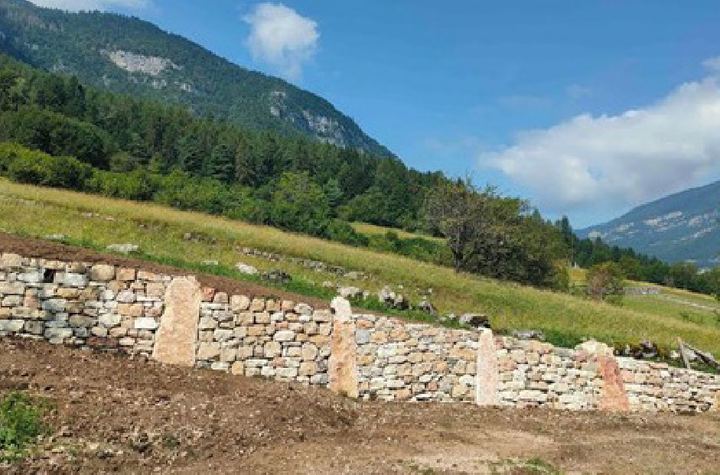
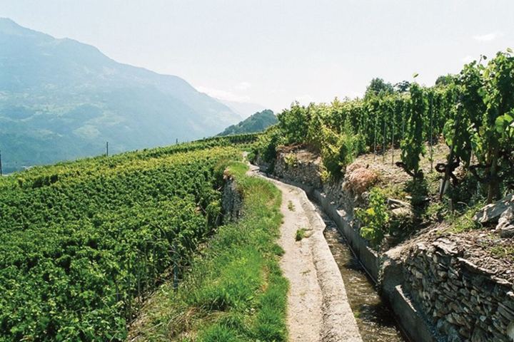
The terraced landscape of the Terragnolo Valley
Affiliations
- 1 La Pimpinella association
International Terraced Landscapes Alliance Journal volume 3, issue 1, pp. 22–49 (2024) · Cite this article
- 209 views
- 178 downloads
- DOI10.5281/zenodo.14561454
Abstract
The steep terraced side of the Terragnolo valley (Trentino, Italy) is today almost completely reforested. Depopulation, which began with the First World War, resulted in the abandonment of cultivation of terraced fields. By traversing the territory on foot, it is possible to discover and recognize its features and concretely visualize the kilometre-long development of the ancient terracing walls with their ecosystems. Walking among terraces, at first glance made uniform by forest, agricultural and manufacturing ruins are revealed. The toponymy of places and oral testimonies help to understand the ancient and recent past of the territory and the new ways of inhabiting the valley. The International Terraced Landscape Festival and Competition, organized by Sassi e non solo and held in the Terragnolo Valley since 2017, aims to promote the ancient construction technique, inscribed in 2018 on the UNESCO’s Representative List of the Intangible Cultural Heritage of Humanity.
Keywords
- terraced landscape
- toponymy
- path
- biodiversity
- festival
Gino Gerola, Le stagioni dei Bortolini
Gino Gerola, The Bortolini seasons
1. Introduction
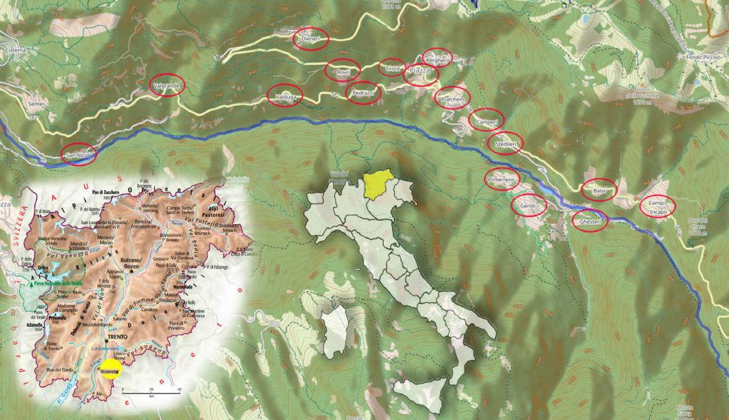
The Terragnolo valley, located in south-eastern Trentino (Figure 1), is a V-shaped valley traversed along its entire length for some twenty kilometres by the Leno stream. Numerous rivulets flow into the stream, which disappear in dry periods. Longitudinally, the valley presents a continuous succession of rises and small valleys. The Leno di Terragnolo, once joined to the branch of the same name that descends from Vallarsa near the town of Rovereto, crosses it and then flows into the river Adige.
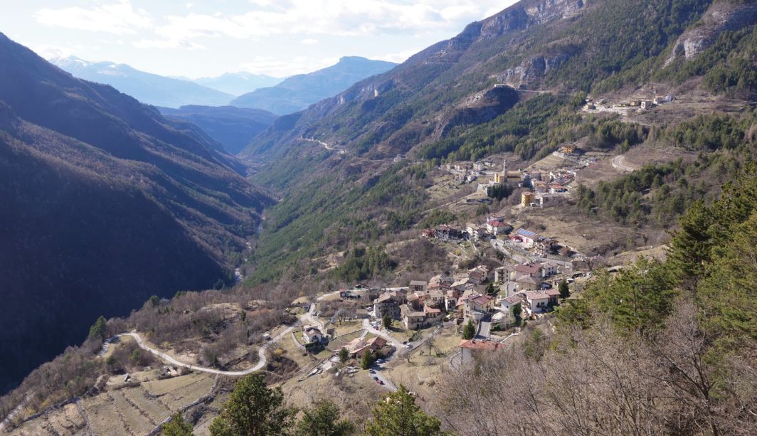
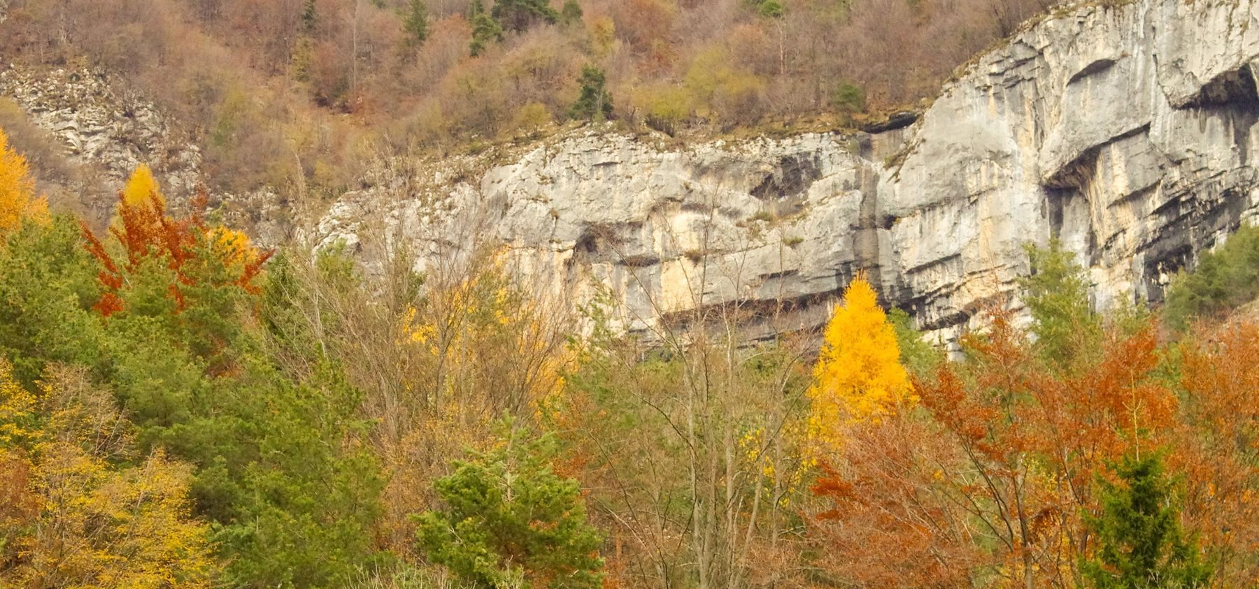
Stretched in a semicircle between the Colsanto Pasubio massif (2232 m.a.s.l.) and the Maggio (1853 m.a.s.l.) and Finonchio (1603 m.a.s.l.) mountains, it is exposed in such a way that one of its slopes is sunlit, while the other remains mostly in the shade (Figure 2). The morphological structure of the valley, characterised by the karstic erosion of its sedimentary rocks with a calcareous or dolomitic composition, has characterised its socio-historical evolution, so that the two slopes have taken on very different landscape characteristics: the orographic right is largely supported by terracing structures, while the left, furrowed by deep avalanches, is covered by woodland.
Christian Schneller, a linguist professor at the end of the 19th century, wrote, searching for the origin of the name Terragnolo (Schneller, 1890, p.167): Thal der kleinen Ebenen (The Valley of the small plateaus), a note of sweetness to define a rugged valley, which has always been linked to the nearby town of Rovereto by trade and small trades. The average slope of the cultivable areas is the highest in the entire southern Trentino (OP, 2017) and is about 23°; 78% of these areas are poorly accessible. These are factors that still today, together with land fragmentation, condition the return to cultivation of the land: the small, even tiny terraces, small patches of land just a few square metres in size, created by stealing land from the slope, are the identity character of the valley, whose landscape is defined as the landscape of toil (Figure 3).
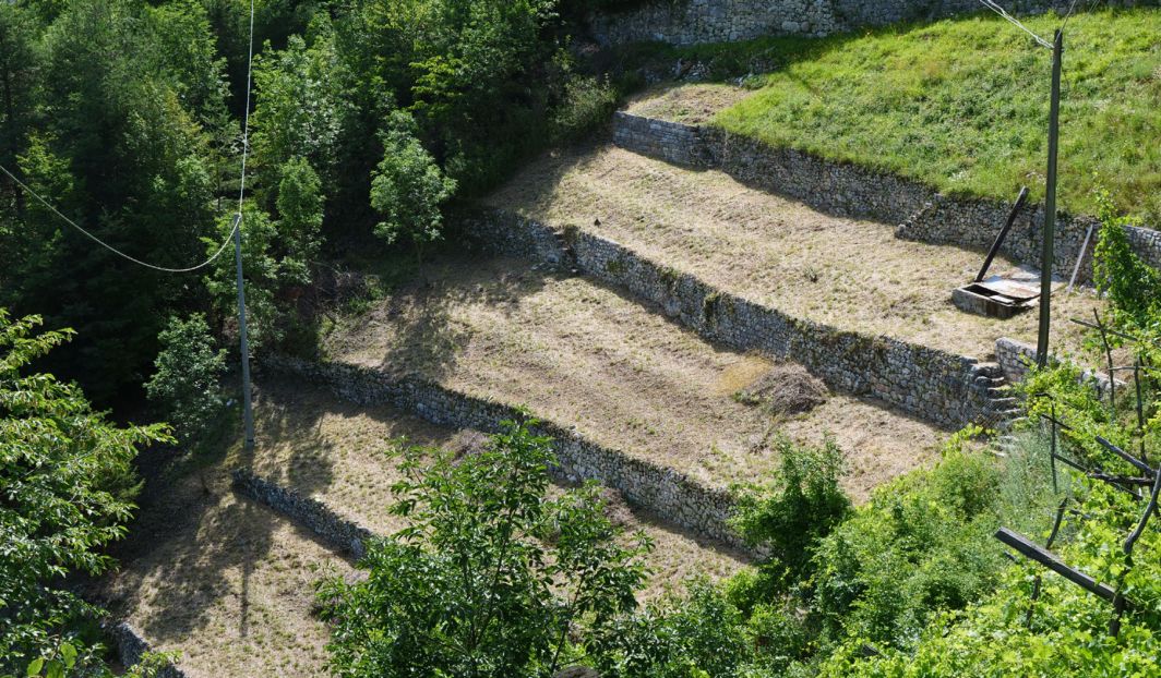
Today, the municipality of Terragnolo has about seven hundred residents divided into thirty-three hamlets, thirty of which are located on the sunny side, some most dedicated to cultivation1,while only three remain on the shaded side, namely Geroli, Pinterreno and Ghesteri, the latter being completely uninhabited.
2. History
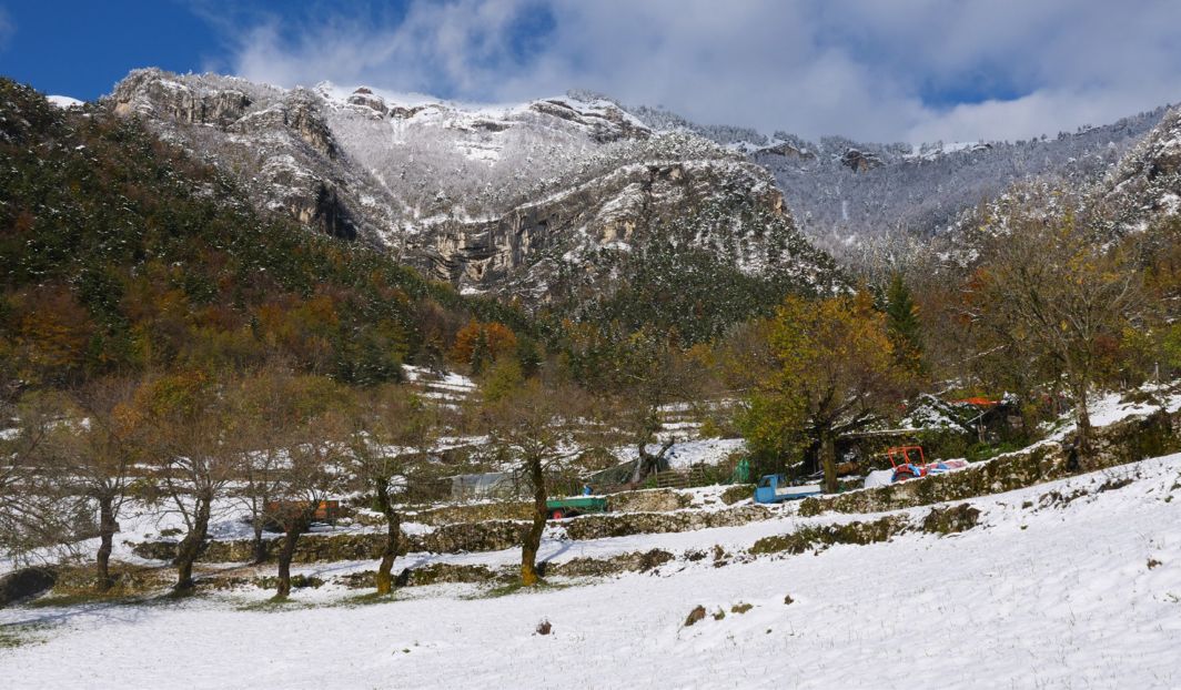
The laborious work of clearing, tilling and levelling the rough slopes began around the year 1200, by specialised labourers of Bavarian Tyrolean origin (Cimbri), the so-called roncadores (Sarzo, 2006; Valduga, 2015). Hundreds of unknown landscape architects remained anonymous, who colonised the valley mixing with the sparse local population, handing down together knowledge and artefacts. Artefacts made to last as long as possible. Of the presence in Terragnolo of this population, traces remain even today in many dialect words, but above all in the very rich local toponymy. It is estimated that in the entire valley about three hundred linear kilometres of retaining structures were raised, with precision and skill, to an average height of 757 metres (Figure 4). The period of maximum inhabited development occurred at the beginning of the nineteenth century, when the population reached the number of about three thousand inhabitants. Subsequently, following the events of the First World War, which saw Terragnolo as a borderland and therefore the site of terrible battles between the Italian and Austro-Hungarian armies, the slow and inexorable depopulation of the territory began, where the subsistence economy could no longer guarantee a future. The identity traits of this valley are well represented in the municipal coat of arms in which an axe and a spade stand out as a reminder of the work of generations of roncadores and a migratory bird resting on the water, a symbol of the migratory destiny of so much of the population.
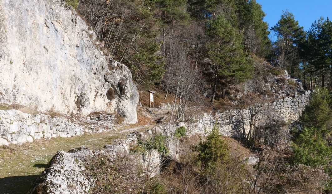
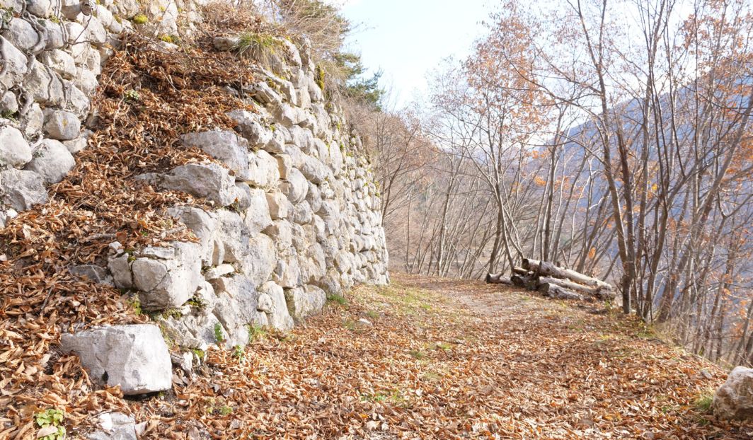
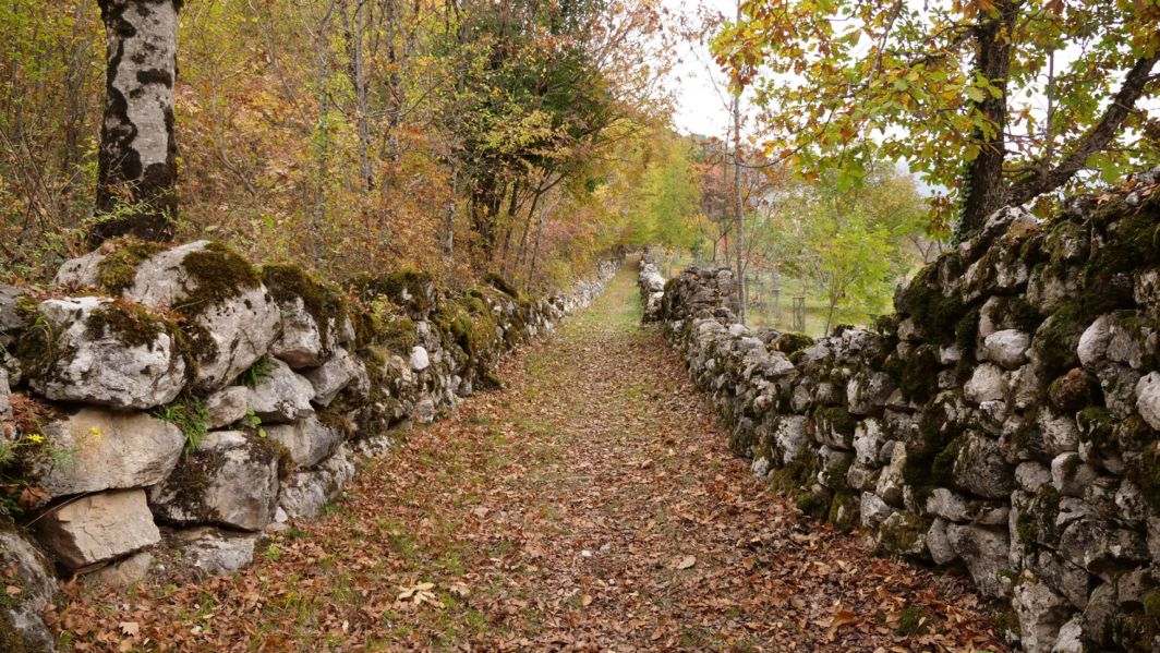
From each of the thirty-three hamlets departed paths, mule tracks (Figure 5) or cart tracks that connected them one to the other, called pontere when they were very steep (the best known is the one that climbed steeply from Valgrande to Scottini); and those stradei, that is, little roads, that once made the terraced cultivated fields accessible right down to the houses2. Many of these small paths that innervated the terraced fields and climbed up from the stream to the woods and meadows for grazing or mowing have unfortunately fallen into disuse and/or been interrupted, but are an essential part of Terragnolo’s cultural landscape. Many others can only be travelled (Figure 6) on foot: a limitation or an opportunity?
3. Toponymy
Every place, no matter how small, but also the small valleys and gullies known as tovi, rocks, stony paths, woods, caves, meadows, fields, was experienced and made familiar with the aid of a name, which represented a sort of address, so much so that the place names in the Terragnolo valley number more than one thousand five hundred and many are of Cimbrian origin (see: https://www.cultura.trentino.it/Patrimonio-on-line/Dizionariotoponomastico-trentino/ ).
It is interesting to cite some of them, both Cimbrian and Latin, relating to terracing: Fratte for clearing the land down to ground level, Laite when the terrain was particularly sloping, Banche where timber was piled up, Langhem, Langaraut, Langarnechele or Vaneze to describe long plateaus, Vigrive for unproductive land; Lambre were the stony ground, Raito, Raut, Raitle, Prechele the cleared land. Higher up, where the terraced soil yielded to the rising mountain slopes and rocks, in the toponymy we find Rive and Rivazzi to indicate mountain ridges, Avalesco, Avanterlin if they were grassy verges; and again Albi, Pozze, Albiot, Aqua, Fontanei to indicate the presence of water; Echile the rises; Vignai and Pomare the land cultivated with vines or apple trees respectively; Carnavecherle indicated a field cultivated with wheat, Ghertarle small vegetable gardens; Brol, Campi, Campetti, Campigoi were large and small fields; Plezzo, Plezzle the clearings. There were also flat points for loading hay and timber, the Cargaore, and those for resting, known as Polsaore.
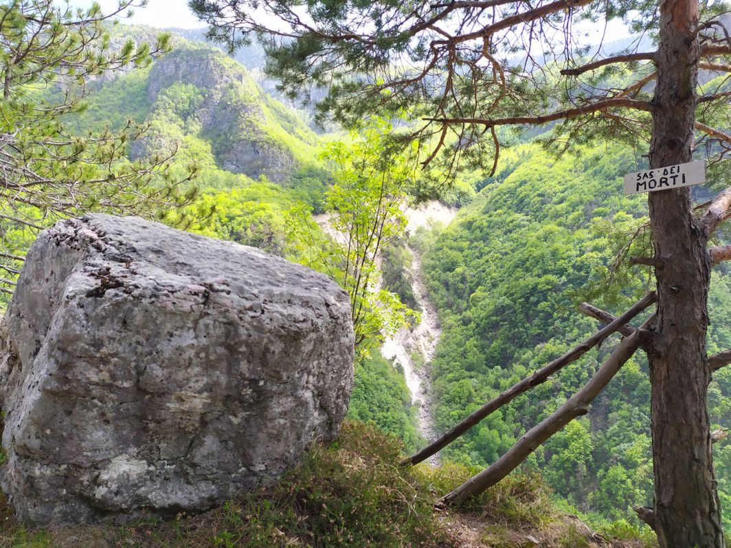
The valley’s inhabitants also relied on large stones to map the territory by sharing names and locations: Terragnolo, rather than being made of a lot of earth, is made of many stones, eroded, broken and turned over, that is, Marochi large and small. This is well known by the rain, which has always, rushing down the valley, sought them out and seduced them one by one... or in small and large landslips Slavine, slavinete, slavinoni. Thus, names have been given to the ledges that crown the valley; then to the many overlapping banks of rock, the Scafe, to the rock steps, to the rock outcrops, to the big rocks, to the landslide rocks, to the rock faces. Of some boulders, some anecdotes are known, even linked to ancient Cimbrian traditions, as in the case of the one called Popolo mio (My little boy), which watches over the village of Zoreri from on high; of others, the particularity of the shape remains in the name, such as that of the Sas3 Quadro (square sas), the Sas Lonch (Long sas), the Lasto; or the funny curiosity for the Sas dei sghiti (Bird droppings sas), or the reference to the bear for the Sas de la Perlum (Perlum sas); the engraving caused by the passage of carts betrays the history of the Sas del Caret (Cart sas); or the name indicated the function in the case of the Sas del Fil from which a cableway departed and the Sas dei morti (Dead Sas) (Figure 7) on which the litter of the deceased carried on the shoulders of the cemetery of San Nicolò at the bottom of the valley was placed; or indicated the nickname of the family to which the boundary of the wood belonged, as for the Sas del Cuiar; or the dark colour of the rocky outcrop of the Sas negro (Dark sas).
4. Yesterday’s and Today Landscape
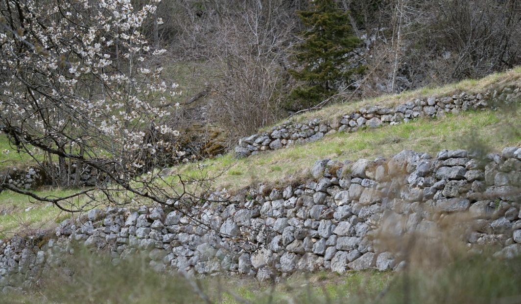
Those rare black and white military photographs from the early 20th century are impressive, or those from the 1930s where a practically bare valley, devoid of forest vegetation, was immortalised. A stage traversed by the infinite clear lines of the retaining structures: linear, interrupted, intertwined, denser where there are high slopes, more rarefied where the slope decreases a little. At present, they are for the most part rendered invisible by the homogenising advance of the forest, which was once kept at a proper distance from the terracing, and which has now taken revenge over more than eighty per cent of the meadows and fields. For this reason, one can only get a good idea of the succession of terraces (Figure 8) by crossing the land on foot, paying attention to what the green blanket of the forest conceals. One passes by walls sometimes clawed by ivy, which gets into the cracks and melts into the ashlars so much so that one ends up not being able to tell which one is carrying and which one is clinging on.
5. Agriculture in the Past
The crops of yesteryear, until the mid-20th century, were those of a self-sustenance economy, spread over a dry land, poor in nutrients, where the manure, la grassa was brought to the fields using the fil, small cableways where possible, or, by the women, over their shoulders, even relaying between them. For this purpose, the so-called bénewere used, sturdy baskets (and obviously permeable to sewage...) woven from the flexible branches of the hazel tree, the size of which could vary depending on the function performed, if the contents to be transported were soil, fertiliser, vegetables, hay, wood, coal: Gh’era le bene da slita e quele da carga - There were sled baskets and cargo baskets (Ronz C. ) “Ah, se ne ho fat su de béne sti anni coi noselèri” – Ah, how many baskets I built with halz branches (Peterlini F.); “En primavera ne tocheva portar su con la zivera la tera che rudoleva zo in inverno” – In the spring we had to carry high the earth that rolled down in winter using a stretcher (Zencher M.) can still be heard today from the elderly, who keep those daily tribulations etched in their memories.
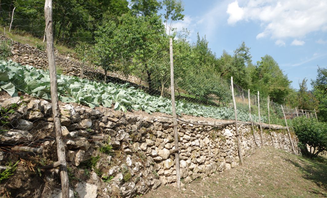
Together with the exploitation of the forest, from logging to the cooking of coal and lime, to the domestic rearing of a few cows, pigs, goats and rabbits, the multi-crop horticulture and fruit-growing ensured, albeit meagrely, family survival. Wheat, barley, rye, cabbage (Figure 9), potatoes and turnips were also cultivated and sold in exchange for zaldo, i.e. corn for cooking polenta, which was the staple food of the population until the 1950s.4 The area planted with vines, the so-called Vignai, was mainly that of the bottom of the valley near San Nicolò, Fontanelle, and that descending from Serrada towards Valduga. “Under each vineyard, next to the retaining wall, a strip of buckwheat was sown” (Ronz C.). “At the bottom of every arbour on the path is the bigoncia (conzal), which, when it is full, is carried on the shoulders across the steep paths and up the steps to the road, where the vats (brentoni) are” (Mattevi,1957 p.57). Even today, those few who still tend the small family vineyards carry the grapes uphill in buckets.
The possibility of irrigation used to determine crop yields. Some terraced fields just upstream of the Leno stream were devoted to the cultivation of beans, precisely because of the easy access to water. Two toponyms identifying the small fields below Valduga are curious and significant: Cucagna the first (Cuccagna: fabulous country, without worries, where abundance is the norm), Merica the second (America, the land of dreams, of the coveted well-being to which many desperately emigrated). A few rare tobacco plants were cultivated furtively in the higher fields, hidden among the rame dei fasoi, i.e. branches to make runnerbeans grow (Potrich. P.).
Cherry, apple and pear trees prevailed on the higher terraces. Many still remain, often as relics among brambles, crushed by ivy and dried up to hide a fruit biodiversity that is not entirely lost, and perhaps to be revalued. Like the quality of Villari apples, the mizi peri, the one-lire pear trees, ripening from a solitary plant in a field below Castello, frequented mainly by chamois. “Pear trees so large that they could be sold for a lira each” (Zencher G). With apples “The farmers used to make cider for family use, and the Gasperi, who at Scottini, a thousand metres above sea level, cultivated hops, produced their own beer until the 1950s’” (Valduga L.). A few years ago, a young man started growing hops again: “The inflorescences are used to make beer, but the tender, delicate shoots are excellent to eat” (Scrinzi R.).
A local grape variety, called Nera dei Baisi to refer to the hamlet where there was only one vineyard left, was instead saved from extinction thanks to the project of a Vallagarina5 winery.
On the small plains, there was no lack of mulberry trees, the leaves of which had been used since the end of the 1600s to feed silkworms, the cavaleri, bred on special reed trellises, the arele: together with the slite (cargo sleds), some still protrude from the attics, le teze, of the oldest dwellings in Terragnolo, since silkworm cultivation, especially from the early 1800s (Cobelli, 1872) and up to the mid-1950s, contributed to the family income. “Sul ciglio del muro gh’era i gelsi, drio i fasoi, poi le patate o altri ortaggi, zo e zo fim al Lem” - On the edge of the wall were the mulberries, behinds the beans, then the potatoes and other vegetables, down and down to the Leno (Ronz C.). Then came the First World War to devastate the territory: “With the military order of a sudden displacement, there were those who, out of desperation and with a loving gesture, freed all the silkworms under mulberry trees” (Valduga L.) In the heart of the hamlet of Perini, a beautiful old plant welcomes visitors, in Baisi others, periodically pruned, look out over the valley, but if you look closely, you can still find them, albeit now rare, among the houses and in the fields of almost all the hamlets of Terragnolo. On the paths between the terraced fields in springtime, the yellow cornel blossoms, and at the end of summer, its red berries offer both sight and taste. A hard wood its, once used to make the handles of axes, hammers, mallets.
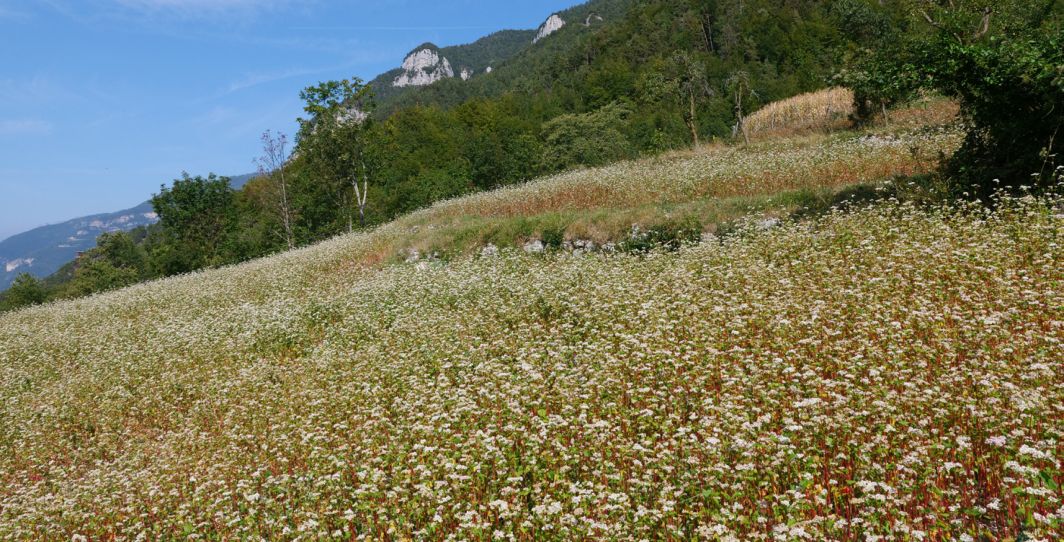
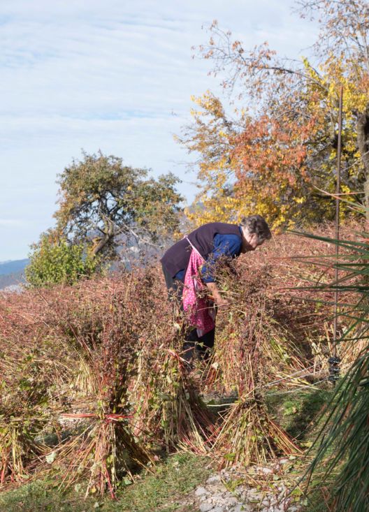
A lot of formentom, that is buckwheat, was sown as a second crop, after potatoes or grasses, i.e. wheat, rye, and barley. Not a cereal but a polygonaceous plant, whose food use is, however, similar to that of grasses, which is well adapted to growing on the leanest soils. Visual impressions of the terraced landscape run through those who remember it all being cultivated, comparing it to a garden: “Observed from above, during flowering, the spectacle of the white patches of earth (Figure 10) juxtaposed with the colours of the other crops in fields and fields, one next to the other, was moving” (Zencher P.). The formentom, having reached maturity, was harvested by uprooting it by hand or cutting it off at the base with the zesla (sickle) or by hand, above all and again by women, and left to dry and darken in the field, gathered into characteristic small sheaves (Figure 11) known as donéte, small women, with a red skirt given by the colour of the stalks. “Ghe se vol terem magro per farlo madurar, altrimenti el mateza” (Gerola E.), “el stramazza” (Valduga L.): it must be sown on thin soil for it to ripen, otherwise it bends.
With black buckwheat flour, polenta mora, dark, was cooked; or a sort of thin, traditional alpine bread was prepared, different from family to family, called fanzelto, by mixing together water, salt and flour to form a dense dough and frying it in an iron pan with lard, in the shape of a pancake. The recipe is now a “DeCo”6.
This irreverent inscription is curious: “They also say (the people of Rovereto) that the fields are so steep that the valley dwellers stick the manure to the ground with a mistletoe to make it stick to them, and to sow the beech trees, they shoot them with a revolver, and finally, so that the eggs don’t run into the stream, they stick a bag on the chickens” (Ferrari, 1934 p. 4).
6. Women Trade and Terragnole Path
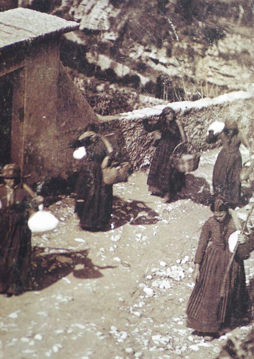
In the not-too-distant past, that is, up until the end of the 1950s - those who can bear direct witness to this are still alive -, it was the women (the Teragnole) who took care of the small trades from which they drew a meagre income, very important for the family economy. Leaving before dawn by the dim light of oil lamps, they would walk down to Rovereto, to the town, coi rufi ai pei (jute or rag shoes on their feet) (Zencher M. ) and the scarpeloti, (crampons) in winter, carrying on their shoulders, hanging from hooks on a curved wood called zerla, the raminei milk canisters, baskets with butter, cheese, fruit depending on the season, mushrooms, mountain flowers (cyclamens, lilies of the valley, gentians, negritella and rhododendrons), legumes and even bundles of wood, pine cones to light the fire, even la zendro per far la lissia (Stedile M.), ash to prepare lye: all to make some small profit, or to exchange their produce for maize flour (Stedile, 2009). In some cases, between the outward and return journeys (Figure 12), the kilometres travelled on foot each day were between twenty and thirty, first downhill and then, finally, uphill, to look after family and animals. This path, today very popular, twelve kilometres long, restored in 2009 and enriched since 2013 with six illustrative notice boards describing the peculiarities of the area, was named Sentiero delle Terragnole (Terragnole Path), in memory of their labours.
7. Building Techniques
Some elderly people from Terragnolo still testify to the technique of building, but above all repairing walls, which was not usually a solitary task, but done at least in pairs using livera and leverim, mazot and sgiandim, martelina, pic and bail, barele e slite de legn per portar i sasi7.
Water in the terraces was, and is, the great absentee. Every source, even the smallest, was structured and used: the name fonte del Piocio8 (a small one with a low but constant inflow) speaks volumes. It was collected in special wells, tanks, fountains. Walking along the paths or crossing the bush, one still comes across these artefacts placed under the long walls: the oldest ones are made of stone, the most recent ones of cement, and in any case, those built after 1940, which sometimes still glow blue from the verdigris and slaked lime dissolved in them to be sprayed on the vines. “... these terraces that climb stubbornly by the dozens from the stream down to below the woods, not as far as there is economic convenience, but as far as the law of gravity allows the masonry and the earth to remain standing, not for years but at least until the end of the season.” (Ferrari, 1934 p.13).
8. Present Activities
8.1. Exploring terraced landscapes
To walk now in the Terragnolo valley (Schmid, 2020) is to follow, in silence, dozens of paths branching out mainly through the bush, starting from two main arterial roads that descend to Rovereto town. The network of minor paths is almost entirely among the dishevelled terraced landscape, unfortunately in inevitable decline, largely abandoned but nevertheless rich in evidence of the exploitation of the forest - for example the disused overhanging wires -, agricultural activity, milling and smelting.
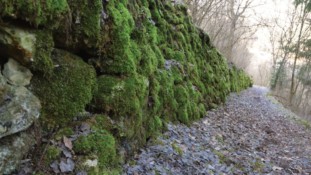
In summer, listening to the shrill, incessant chirping of cicadas where the exposure is sunny, one can pause to discover the rich, walled flora (Stedile, Sarzo, 2016), which in ancient times was also used in traditional medicine, and be surprised by the wildflowers or the coming and going of a titmouse that has nested in a cavity between the ashlars. The shady walls, those close to the stream, are instead cloaked in thick layers of damp mosses (Figure 13) and ferns, inhabited by snails and salamanders that are not difficult to encounter on rainy days.
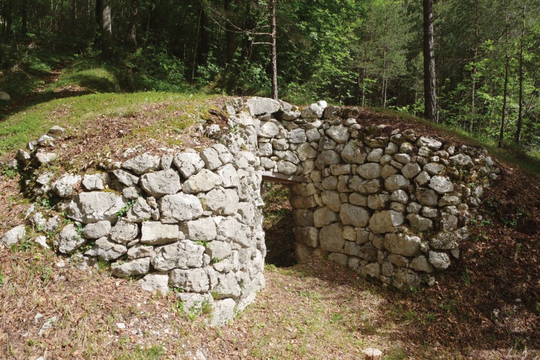
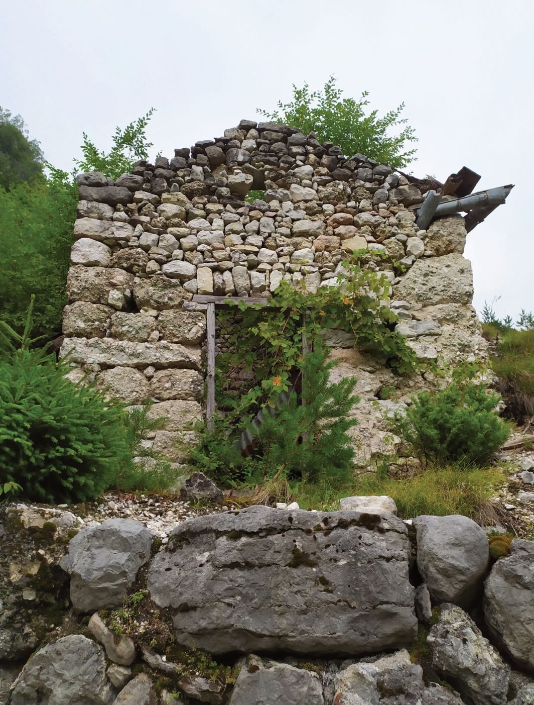
In winter, on the other hand, when the valley lays bare its stone skeleton, it is certainly easier to notice the great work of domestication of the mountain territory and to identify not only the network of dry-stone walls, high, low, double-sided, pitched, with or without access steps, built overhanging or inside the walls themselves, but also all the other rural architecture functional to it. Some seventy ruins of old casote ai vignai and baitei are recorded in a precious volume by Luigi Valduga, a passionate historian of Terragnolo, but these are joined by those of sawmills, mills, forges, about eighty calchere (Figure 14) - furnaces to produce lime, and the now practically invisible traces of about sixty charcoal kilns (Valduga, 2010). It is also possible to come across the remains of military artefacts dating back to the First World War: walls supporting cableways, ruins of barracks, small fountains for supplying water to the troops. A stratification of history to be read: a rusty sickle, a dented enamelled cup, a bent fork, a shrapnel may jump out from the stones of the walls; in the old ruins, a barrel, a wooden rake, skeins of wire recovered from disused vineyards, metal buckets abandoned before saying goodbye, a hand-beaten nail slowly slipping out of a door, while a vine shoot (Figure 15) looks for another opportunity.
It is therefore necessary to walk in order to observe the many stones: hundreds of thousands of them wedged together in terracing walls; those superimposed in the elementary geometries of buildings and in the calchere; those chamfered to make the pavement of paths and in which one often notices the grooves cut by the skids of heavy sledges; those skilfully worked to become artefacts such as albi drinking troughs in which wild amphibians now breed, millstones and pestles, called pile, which are not infrequently found displayed with affection in front of houses. Boundary stones, tombstones, even dating back to the 1600s, testify to the transit along the ancient and dangerous paths. Some wounded scenes cannot be missed, large stone quarries, from which pearl-grey marble was extracted up to seventy years ago. “But each family had its own small stone quarry” (Zencher G.). The stones are reduced, even in the place names, into smaller and smaller pieces: stones accumulated in the marogne e marognette, i.e. in the destonerments, or crumbled in the gère. Pebbles, which become grains in the gully known as La riso or which finally pulverise and knead into clay, the so-called lea, once used to work the roof tiles by hand.
A few small fields, albeit uncultivated, and a few paths in the valley are periodically cleared of brush at their own expense by individuals or groups of volunteers: a struggle to stem the wood and the advance of brambles repaid by the beauty of the geometry of the landscape. Certainly, every small individual action, the care of the small and the possible, is useful in adding aesthetic value to the old walls of the valley. For years, the Proloco of the hamlet of Zoreri has been giving a tangible example of cooperation in the restoration of historical pathways, cleaning up some terraces, reconstructing footbridges on the Leno stream.
8.2. Cultivation of food from autochthonous seeds
A few years ago, a project was started in some terraced fields to reintroduce the voluntary and collective cultivation of buckwheat. The seed is an autochthonous one, an ecotype from Terragnolo, as certified by the typification carried out by the University of Padua, to which the Associazione la Pimpinella (an association that deals with the recovery, rescue and conservation of the horticultural and fruit-growing heritage of the Trentino valleys) had handed over some seeds entrusted to it by a historical farmer of the valley, Francesco “Franz” Potrich. “Eating is an agricultural act”, wrote W. Berry, an American poet, farmer and environmentalist (Berry, 2015): in autumn, before the harvest, a community walk is organised among the ‘formentom’ fields, an agro-cultural itinerary to discover or rediscover how much the agricultural territory and eating habits modify the landscape. This ambitious project has moreover evolved into the purchase of a community mill, inaugurated in the hamlet of Zoreri in 2022.
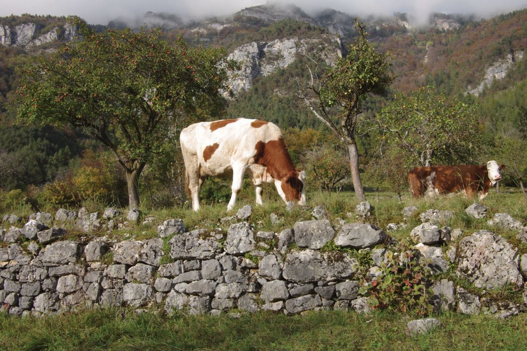
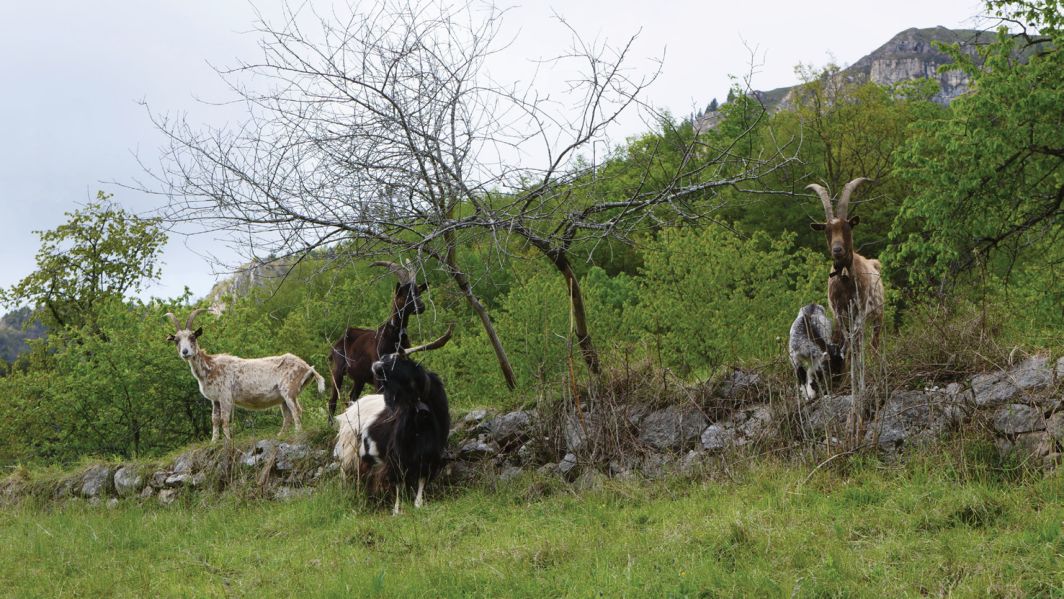
Beans, cabbage, potatoes, leeks, onions: these too are cultivated today in the vegetable gardens that climb the Terragnolo valley. And turnips, the seeds of which G. Peterlini and also saved and valorised by Pimpinella are another product that could be said to be the identity of this terraced valley, like certain types of climbing beans, the fasoi da la rama: “Ghe se vol late alte almem tre metri, de frassem e coi speronzini en do tacarse per farli rampegar su ben, se no, i casca zo” (Gerola E.), poles at least three metres high are needed for them to climb, made of ash wood, with small spurs to make them climb well, otherwise they fall. With one important difference from the past: with the return of the forest, the disturbing presence of ungulates that cross the fields down to below and houses, deer above all, roe deer and chamois, forces one to fence off every sown or cultivated place and this factor is a further disincentive to take up terraced fields again. As well as the presence of the wolf, which recently alarmed Leonardo G. who raises cattle (Figures 16, 17) and the passage of the bear destroyed some beehives a few years ago.
8.3. Buildings restoration
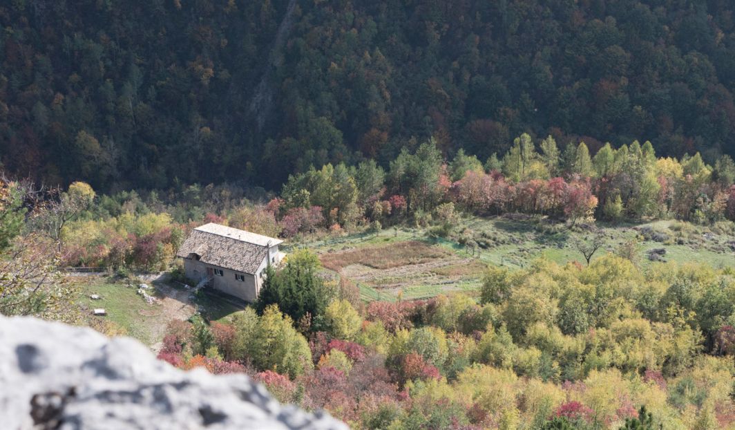
A recent and interesting restoration of a large rural building (Figure 18) and the wide terraces on which it stands is being consolidated at the Mas della Cesura. The cesure were formerly enclosed, fenced areas: in this case, precisely by large, double-sided dry-stone walls (Figure 19). An engineer, a lover of landscape and good food, has restored a large area that had remained uncultivated for decades, planting hedges, fruit trees of both new and local varieties; giving vigour to a large vegetable garden; sowing a field of buckwheat and planting hundreds of lavender plants, hosting a few bee hives: “It’s great to have chamois and roe deer grazing in front of the doorway, but everything I want to produce, I have to protect by raising high fences! Including the young fruit trees that I must wrap in netting cylinders to save them from the bites of the deer that lean and stand up to over two metres” (Dapor V.)
9. Terraced Landscapes Festival
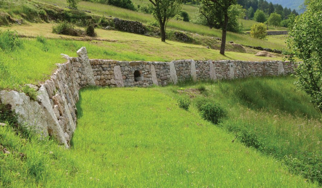
Terragnolo is the ideal rural landscape, with its slopes and terraces of all sizes, for the annual Festival and international contest on the terraced landscape, organised since 2017 by the SASSI E NON SOLO 9 association together with the Trentino Dry Stone School, which cultivates and passes on this type of non-polluting construction technique, knowledge of which is necessary for the restoration and maintenance of the terraced landscape. The Festival takes place in Geroli, which can be reached by travelling along the entire length of the valley and thus being able to see the entire extent of the Terragnolo territory and catch a glimpse of the terracing. In Geroli, large plots of rough meadows are still mowed, which in the spring display a spectacular flowering. It is a concrete and discreet festival, hosting national and international masters. It is not folklore, but a cooperative event, in which teams of expert dry-stone craftsmen compete from dawn to dusk in the reconstruction from scratch of a section of terracing wall without using any kind of binder, leaving in place not so much new retaining walls as small works of art and a long vision of the future of the middle lands forced to accept, after that of depopulation, also the challenge of ongoing climate change. A further contribution of the Festival, its added value, is that of allowing an inexperienced public to see the construction and appreciate the artefact from its foundations to its crowning, listening to an ancient tapping: if in fact one understands the function of a wall built in dry stone, at first glance one does not perceive the soul, or rather, one does not see it. The sober and powerful soul remains hidden, rooted in the earth or among the stones, and is visible only on two occasions: if one is lucky, in the moment of the birth of the “little wall”, or more and more frequently, in the fields and woods, in the clean agony of the return of the pieces to the earth. Walls, too, are born bare and clean, then as they become more familiar, they grow fat with earth and colour. Therefore, if one does not really need to build a dry-stone wall from scratch, at the Festival in Terragnolo one has the opportunity to look at just where the soul of the walls sinks, which in a handful of hours, is assigned to them by the artisan builders, in their image and likeness (Figure 20). Then, only the façade remains to reveal the wall’s profound relationship with its “world within”, and in the Terragnolo valley, alongside the thousands of traditional historical façades, others are slowly being added, with new languages. One section of these walls has different stones, but all perfectly square, in another they are sought to be all of the same hue; there is the wall that does not care if one of its stones is rounder than the others, or less dressed or darker, less sharp or rougher. In some, the dimensions of the stones must absolutely resemble each other, which is not so important for others; the one in which the ashlars have been intentionally stacked all at an angle; in one there is no breathing space between stone and stone, in the other the spaces between the ashlars have been filled with thin flakes; the one with the flower in the centre, the one that cages a pot-bellied deer or holds an auspicious statuette; in the niche of the last of a cordonata a round sas ru has been laid. Some stones bear engraved symbols or alphabets identifying the culture of those who made them. Who knows how different the next wall will be, what language it will speak, while respecting the rules of art, harmony and intonation with the environment of Geroli. A young enrichment, both functional and aesthetic, for a valley with a history as ancient as that of Terragnolo and from which it would have everything to gain.
10. Conclusion
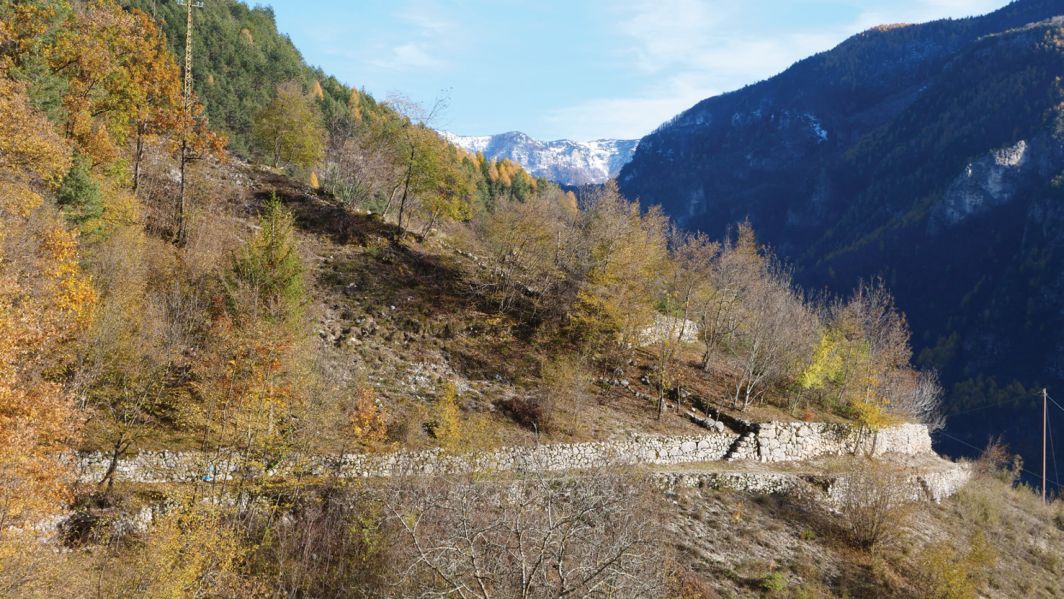
Terragnolo’s terraced landscape, of simple and unarmed beauty (Figure 21), would need constant maintenance for its redevelopment, even for tourism, which would in any case remain a niche, now that for years the sweat and forced steps of the population have been replaced by the slow and relaxed ones of hikers.
To the question of who then is Terragnolo’s terraced landscape, one could perhaps answer: the landscape is in the eyes of all those who see it and in the hands of those who, in whatever capacity, transform it, paradoxically even without moving a finger.
References
- Berry, W. (2015) Mangiare è un atto agricolo. Torino: Lindau.
- Cobelli, R. (1872) Cenni storici e statistici sulla bachicoltura nel Trentino. Rovereto: Sottochiesa.
- Gerola, G. (1990) Le stagioni dei Bortolini. Trento: Luigi Reverdito editore.
- Ganassini, M. Costruzione trasformazione delle architetture nella valle di Terragnolo. Tesi di laurea Università degli studi di Trento anno accademico 2010-2011.
- Ferrari, F. La piccola proprietà nella valle di Terragnolo. Tesi di laurea Regia Università di Firenze, 1934.
- Mattevi, L. La geografia antropica della valle di Terragnolo. Tesi di laurea Università Cattolica del Sacro Cuore in Milano anno accademico 1956-1957.
- OP Osservatorio del paesaggio trentino (2017) Paesaggi rurali della Valle del Leno. Quaderni di lavoro 07.
- Sarzo, A. (2006) Il paesaggio dell'abbandono nel circondario agreste di Senter (Valle di Terragnolo, Trentino). Annali Museo Civico Rovereto 22, pp. 111-170.
- Schmid, S. (2020) Attraverso Terragnolo. Rovereto: Tipografia Baldo.
- Schneller, C. (1890) Tirolische Namenforschungen. Innsbruck: Verlag Wagner.
- Stedile, R. Sarzo, A. (2016) Pietre vive. I muretti a secco nella valle di Terragnolo available in https://youtu.be/8GSyv6iDsxY
- Valduga, L. (2010) Terragnolo Ricerche, storia, notizie. Rovereto: Grafiche Stile.
- Valduga, L. (2015) Cosa resta dei Cimbri nella valle di Terragnolo. Rovereto: Tipografia Baldo.
- Stedile, R. (2009) El raminel del late, le fascinele de legna, i fonghi, la zerla….Quando le "teragnole" scendevano a Rovereto. Rovereto: Tipografia Baldo.
- https://www.cultura.trentino.it/Patrimonio-on-line/Dizionario-toponomastico-trentino/
- Oral testimonies with: Dapor V.; Gerola E.; Peterlini F.; Potrich M.; Potrich P. ; Ronz C.; Scrinzi R.; Stedile M.; Valduga L.; Zencher G.; Zencher P.; Zencher M.
Notes
- San Nicolò, Fontanelle, Perini, Potrich, Valgrande, Valduga, Scottini, Pornal, Dieneri, Peltreri, Pedrazzi Piazza - municipal seat, Dosso, Puechem, Rovri, Croce, Castello, Costa, Valle, Pergheri, Zencheri, Stedileri, Sega, Maureri, Camperi, Baisi, Soldati, Zoreri, Incapo, Campi.
- These were once built close to each other and ‘housed not only the residential function, but also the agricultural one, having spaces specifically intended for the first processing and preservation of the products of the fields’ (Ganassini, 2011, p.46).
- The dialect term “Sas” means stone.
- “The basis of the diet is polenta, which between large and small is consumed on average three quarters of a kilogram per person per day and is all bought in town” (Ferrari,1934, p.19).
- Southern valley of Trentino crossed by Adige river.
- De.Co.: municipal denomination of origin
- These are tools used to dig, split, move stones and earth.
- Louse source.
- https://www.facebook.com/sassienonsolo
Rights and permissions
Open Access. This article is licensed under a Creative Commons CC BY 4.0 license, which permits use, sharing, adaptation, distribution and reproduction in any medium or format, as long as you give appropriate credit to the original author(s) and the source and indicate if changes were made.
About this article
Cite this article
Schmid, S. (2024). The terraced landscape of the Terragnolo Valley. International Terraced Landscapes Alliance Journal, 3(1), 22–49. https://doi.org/10.5281/zenodo.14561454
- Published
- December 2024
- Issue
- Volume 3, Number 1
- Journal
- International Terraced Landscapes Alliance Journal, ISSN 2754-7639 (Online)
- Archive
- Zenodo record 14561454
- terraced landscape
- toponymy
- path
- biodiversity
- festival